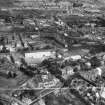
Paisley, Underwood Road, Underwood Mill
Cotton Mill (18th Century), Steam Engine (18th Century), Weaving Mill (19th Century)
Site Name Paisley, Underwood Road, Underwood Mill
Classification Cotton Mill (18th Century), Steam Engine (18th Century), Weaving Mill (19th Century)
Canmore ID 43192
Site Number NS46SE 63
NGR NS 47743 64322
Datum OSGB36 - NGR
Permalink http://canmore.org.uk/site/43192
- Council Renfrewshire
- Parish Paisley (Renfrew)
- Former Region Strathclyde
- Former District Renfrew
- Former County Renfrewshire
NS46SE 63 477 641
(Location cited as NS 478 642). Founded in the 1780s and rebuilt in the 1860s as a thread mill. The main building is a 3-storey-and-attic, 3-by-14-bay structure, with 7- and 8-bay blocks of north-light weaving sheds at the rear. Other three-storey parts were destroyed by fire in 1971. Now a wool store, after a period as the Arrol-Johnson motor-car factory.
J R Hume 1976.
Note
The ID entry 700475 for this site conflates two buildings, Underwood Mill and a thread works to the south (NS46SE 631). The J R Hume report based on fieldwork (The Industrial Archaeology of Scotland, 1: Lowlands and Borders, 1976, 221-2) refers to the remaining buildings of NS46SE 631, Underwood Mill on Underwood Road presumably having been demolished prior to 1976.
Underwood Mill is depicted and named 'Underwood Mill (Cotton)' on the Ordnance Survey 1st edition 25-inch map (Renfrew, 1864, sheet XII.2), as 'Thread Mill' on the 2nd edition 25-inch map (Renfrew, 1898, sheet XII.2). sheet XII.2) and as 'Weaving Mill' on the 3rd and Provisional editions 25-inch map (Renfrew, 1913 and 1939, sheet XII.2).
Hume does refer to the mill having been founded in the 1780s and converted a Thread Mill in the 1860s which is borne out by the map evidence. This site of the mill has been given a more accurate grid reference.
Information from RCAHMS (MMD), 13 February 2012.


