Scheduled Maintenance
Please be advised that this website will undergo scheduled maintenance on the following dates: •
Tuesday 3rd December 11:00-15:00
During these times, some services may be temporarily unavailable. We apologise for any inconvenience this may cause.
Rowallan Castle
Castle (Medieval), Country House (Period Unassigned), Bottle (Post Medieval), Unidentified Pottery(S) (Post Medieval)
Site Name Rowallan Castle
Classification Castle (Medieval), Country House (Period Unassigned), Bottle (Post Medieval), Unidentified Pottery(S) (Post Medieval)
Alternative Name(s) Rowallan Old Castle
Canmore ID 42975
Site Number NS44SW 9
NGR NS 43472 42427
Datum OSGB36 - NGR
Permalink http://canmore.org.uk/site/42975
First 100 images shown. See the Collections panel (below) for a link to all digital images.
- Council East Ayrshire
- Parish Kilmarnock
- Former Region Strathclyde
- Former District Kilmarnock And Loudoun
- Former County Ayrshire
NS44SW 9.01 Centred NS 43459 42460 Garden
NS44SW 9.02 Cancelled
NS44SW 9.03 NS 43566 42422 New Bridge (Carmel Water)
NS44SW 9.04 NS 43550 42439 Old Bridge (Carmel Water)
See also NS44SW 33.11 NS 43449 41994 Rowallan House, Lodge
(NS 43472 42427) Rowallan Castle (NR)
OS 6" map (1968)
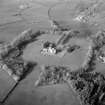
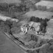
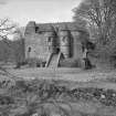
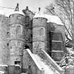
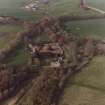
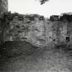
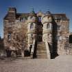
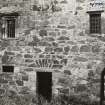
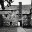
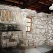
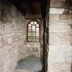
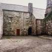
Rowallan Castle is a 16th-17th century mansion built on three sides around the knoll on which, in the NE of the courtyard, are fragmentary remains, probably of the original tower, built on this site in 1263 or soon after (noted as 'ruined' on plan). If so, it was a keep, measuring about 35 1/2ft by 28ft. A courtyard wall closes the W side. Of the present castle, the earliest parts, i.e. the S and E sides, date from the 16th century. The entrance, on the E, is dated '1562', it is flanked by two drum towers. The W part of the N side is 17th century. The gateway, leading to another courtyard NE of the mansion is dated 1661.
D MacGibbon and T Ross 1887; N Tranter 1965
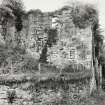
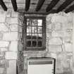
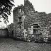
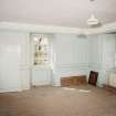
The remains of Rowallan Castle are generally as described. The whole N block is ruinous, with the walls standing one storey high. The E and S wings are roofed and in good repair, and the W courtyard wall is also entire. The E front is now undergoing repairs. The two date stones are still evident. The castle is the property of Lord Rowallan.
Visited by OS (EGC) 9 February 1962
Structural repairs have been carried out, prior to opening the castle to the public.
CBA 1976
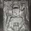
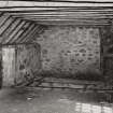
The castle is now under Guardianship and is still being structurally repaired prior to opening to the public. It is unoccupied. For further details of its history see illustration of Guardianship plaque.
Visited by OS (JRL) 24 August 1982
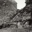
NS 4348 4242 Three seasons of excavation were carried out in 1998-99 at Rowallan Old Castle within the ruined NE tower, thought to be the earliest element of the surviving old castle complex. Prior to the start of the first season, the unroofed tower was filled with rubble from the collapse of the side walls, which survive to a maximum of two storeys over the internal castle courtyard. The excavations cleared the tower interior of debris, to allow for the consolidation of the surviving masonry.
The three seasons of work resulted in the following interim interpretation of the development of the NE tower.
Period 1 Mid-12th to late 14th century. Hall house. Massive stone build with distinctive external basal scarcement. Probably rectangular, aligned N-S. Two storeys.
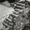
Period 2 Late 14th to early 16th century. Tower house. Rubble build over residual Period 1 masonry. Square in plan, defined by construction of new S wall with intra-mural stair and passage. Probably three storeys, but survives as undercroft and first-floor hall.
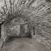
Period 3 Early 16th to later 17th century. Altered tower house. Undercroft enlarged by insertion of barrel vault, raising first-floor level and lowering basement floor level. Alterations to E window.
Period 4 Later 17th to mid-18th century. Decline. Possible backfill and occasional occupation of undercroft.
Period 5 Mid-18th century to present. Abandonment and collapse. Collapse of the vault and stone robbing.
The removal of infill material demonstrated that the mound on which the NE tower is founded is of partly artificial origin; most likely an altered or augmented natural feature. The basal deposits within the cleared NE tower revealed a number of negative features, including post-holes with timber remains in situ, sealed below a crude metalling surface. A number of these features pre-dated the earliest walls of the tower. In addition, a concentration of cremated human remains, associated with a coarse pot, was revealed to the SE of the tower interior; this was interpreted as a prehistoric (Neolithic or Bronze Age) burial site. The settlement and land-use sequence at Rowallan Old Castle can therefore be traced back to prehistory. Further excavation (report in production) during September 1999 sought to further clarify the features revealed at the end of the tower clearance works.
A watching brief was maintained at Rowallan Old Castle during the excavation of a cable trench in August 1999. References to a castle at Rowallan date as far back as 1263. A new mansion was constructed by Lorimer around 1km to the NW in the early 20th century, after which the old castle fell into disrepair.
The cable trench ran around the NW side of the old castle, to the SE of the adjoining tennis court area, before continuing beneath the NW perimeter wall. Thereafter the trench ran along the edge of a field to the SW of the castle greenhouses, and along the E-W access road leading to the new castle. Up to the NW perimeter wall, the trench crossed land under the guardianship of Historic Scotland, and within this area the trench was hand-excavated. Beyond the wall the trench was excavated by machine.
In the area directly to the NW of the 16th-century S range, 19th-century dumping deposits were seen to be cut by modern service pipes, while the N ranges of the castle could be seen to be founded on a natural bedrock outcrop. At the foot of the outcrop, sherds of green-glazed pottery, including a sherd with a strap handle, were recovered, associated with a clay pipe bowl bearing Masonic designs. These represent the only potentially pre-19th-century finds recovered during the excavations. The remainder of the trench proved almost sterile in terms of archaeological material, consisting of a deep horizon of relatively stone-free, undifferentiated sandy clay. A geometric carriage drive shown on the 1st edition OS map of 1856 was cut by the new trench, and the metalling of the road surface, lined on both sides by mature beech, was recorded here.
While the trench did not reveal extensive archaeological features, the watching brief afforded the opportunity to record the topography of the area immediately to the NW of the castle in more detail. The tennis court was seen to be cut at its NW corner into an earlier landscaped bank, topped by mature yew trees. The associated walled gardens are known to date from the 16th century, and contain a further yew some 600 years old. The area which later saw use as a tennis court may have served as an early formal garden, designed to be viewed from the new S range of the castle.
Sponsor: Historic Scotland
D Stewart and A Dunn 1999
NS 4347 4242 Comprehensive analytical re-assessment of the structural and historical evidence for the evolution of this complex building (NS44SW 9.00) and its immediate surrounding landscape was undertaken between October 2004 and March 2005, as a contribution to a conservation plan.
As an additional part of the wider assessment, a geophysical survey was undertaken in order to further investigate evidence noted for outbuildings, gardens and surrounding enclosures.
Sponsor: Duffield Morgan Ltd.
T Addyman 2005.
NS 434 424 An archaeological geophysical survey was carried out in November 2005 within the grounds of Rowallan Castle, East Ayrshire. A resistivity survey was carried out in the immediate area surrounding the old castle and several geophysical anomalies were detected that may represent the remains of stone walls and structures.
Archive to be deposited in NMRS. Report lodged with WoSAS SMR and NMRS.
Sponsor: Duffield Morgan Ltd
Donna M Maguire, 2006.
NMRS REFERENCE
Previously owned by Lord Rowallan, now privately owned by Niall Campbell and family. Guardianship Monument maintained by Historic Scotland.
Architect: N Joyce. Stafford 1869 - additions not carried out.
Ross sketchbooks MS 28/463/12/11-13 Detail: entrance window
Excavation (4 August 1998 - 11 August 1998)
Over the course of 1998 and 1999, Kirkdale Archaeology undertook a variety of archaeological work at Rowallan Castle. During August 1998, Kirkdale carried out a standing building recording of the North Range, as well as test trenching for future excavations.
G Ewart 1998
Sponsor: Historic Scotland
Kirkdale Archaeology
Project (4 August 1998 - 24 October 1999)
NS 4348 4242 Three seasons of excavation were carried out in 1998-99 at Rowallan Old Castle within the ruined NE tower, thought to be the earliest element of the surviving old castle complex. Prior to the start of the first season, the unroofed tower was filled with rubble from the collapse of the side walls, which survive to a maximum of two storeys over the internal castle courtyard. The excavations cleared the tower interior of debris, to allow for the consolidation of the surviving masonry.
The three seasons of work resulted in the following interim interpretation of the development of the NE tower.
Period 1 Mid-12th to late 14th century. Hall house. Massive stone build with distinctive external basal scarcement. Probably rectangular, aligned N-S. Two storeys.
Period 2 Late 14th to early 16th century. Tower house. Rubble build over residual Period 1 masonry. Square in plan, defined by construction of new S wall with intra-mural stair and passage. Probably three storeys, but survives as undercroft and first-floor hall.
Period 3 Early 16th to later 17th century. Altered tower house. Undercroft enlarged by insertion of barrel vault, raising first-floor level and lowering basement floor level. Alterations to E window.
Period 4 Later 17th to mid-18th century. Decline. Possible backfill and occasional occupation of undercroft.
Period 5 Mid-18th century to present. Abandonment and collapse. Collapse of the vault and stone robbing.
The removal of infill material demonstrated that the mound on which the NE tower is founded is of partly artificial origin; most likely an altered or augmented natural feature. The basal deposits within the cleared NE tower revealed a number of negative features, including post-holes with timber remains in situ, sealed below a crude metalling surface. A number of these features pre-dated the earliest walls of the tower. In addition, a concentration of cremated human remains, associated with a coarse pot, was revealed to the SE of the tower interior; this was interpreted as a prehistoric (Neolithic or Bronze Age) burial site. The settlement and land-use sequence at Rowallan Old Castle can therefore be traced back to prehistory. Further excavation (report in production) during September 1999 sought to further clarify the features revealed at the end of the tower clearance works.
A watching brief was maintained at Rowallan Old Castle during the excavation of a cable trench in August 1999. References to a castle at Rowallan date as far back as 1263. A new mansion was constructed by Lorimer around 1km to the NW in the early 20th century, after which the old castle fell into disrepair.
The cable trench ran around the NW side of the old castle, to the SE of the adjoining tennis court area, before continuing beneath the NW perimeter wall. Thereafter the trench ran along the edge of a field to the SW of the castle greenhouses, and along the E-W access road leading to the new castle. Up to the NW perimeter wall, the trench crossed land under the guardianship of Historic Scotland, and within this area the trench was hand-excavated. Beyond the wall the trench was excavated by machine.
In the area directly to the NW of the 16th-century S range, 19th-century dumping deposits were seen to be cut by modern service pipes, while the N ranges of the castle could be seen to be founded on a natural bedrock outcrop. At the foot of the outcrop, sherds of green-glazed pottery, including a sherd with a strap handle, were recovered, associated with a clay pipe bowl bearing Masonic designs. These represent the only potentially pre-19th-century finds recovered during the excavations. The remainder of the trench proved almost sterile in terms of archaeological material, consisting of a deep horizon of relatively stone-free, undifferentiated sandy clay. A geometric carriage drive shown on the 1st edition OS map of 1856 was cut by the new trench, and the metalling of the road surface, lined on both sides by mature beech, was recorded here.
While the trench did not reveal extensive archaeological features, the watching brief afforded the opportunity to record the topography of the area immediately to the NW of the castle in more detail. The tennis court was seen to be cut at its NW corner into an earlier landscaped bank, topped by mature yew trees. The associated walled gardens are known to date from the 16th century, and contain a further yew some 600 years old. The area which later saw use as a tennis court may have served as an early formal garden, designed to be viewed from the new S range of the castle.
G Ewart, D Stewart and A Dunn 1999
Sponsor: Historic Scotland
Kirkdale Archaeology
Excavation (19 October 1998 - 6 November 1998)
Over the course of 1998 and 1999, Kirkdale Archaeology undertook a variety of archaeological work at Rowallan Castle. During October 1998, Kirkdale carried out a standing building recording and excavation of the ruined tower house.
G Ewart 1998
Sponsor: Historic Scotland
Kirkdale Archaeology
Watching Brief (11 August 1999 - 19 August 1999)
A watching brief was maintained at Rowallan Old Castle during the excavation of a cable trench in August 1999. References to a castle at Rowallan date as far back as 1263. A new mansion was constructed by Lorimer around 1km to the NW in the early 20th century, after which the old castle fell into disrepair.
The cable trench ran around the NW side of the old castle, to the SE of the adjoining tennis court area, before continuing beneath the NW perimeter wall. Thereafter the trench ran along the edge of a field to the SW of the castle greenhouses, and along the E-W access road leading to the new castle. Up to the NW perimeter wall, the trench crossed land under the guardianship of Historic Scotland, and within this area the trench was hand-excavated. Beyond the wall the trench was excavated by machine.
In the area directly to the NW of the 16th-century S range, 19th-century dumping deposits were seen to be cut by modern service pipes, while the N ranges of the castle could be seen to be founded on a natural bedrock outcrop. At the foot of the outcrop, sherds of green-glazed pottery, including a sherd with a strap handle, were recovered, associated with a clay pipe bowl bearing Masonic designs. These represent the only potentially pre-19th-century finds recovered during the excavations. The remainder of the trench proved almost sterile in terms of archaeological material, consisting of a deep horizon of relatively stone-free, undifferentiated sandy clay. A geometric carriage drive shown on the 1st edition OS map of 1856 was cut by the new trench, and the metalling of the road surface, lined on both sides by mature beech, was recorded here.
While the trench did not reveal extensive archaeological features, the watching brief afforded the opportunity to record the topography of the area immediately to the NW of the castle in more detail. The tennis court was seen to be cut at its NW corner into an earlier landscaped bank, topped by mature yew trees. The associated walled gardens are known to date from the 16th century, and contain a further yew some 600 years old. The area which later saw use as a tennis court may have served as an early formal garden, designed to be viewed from the new S range of the castle.
D Stewart and A Dunn 1999
Sponsor: Historic Scotland
Kirkdale Archaeology
Excavation (10 May 1999 - 15 June 1999)
Over the course of 1998 and 1999, Kirkdale Archaeology undertook a variety of archaeological work at Rowallan Castle. During May and June 1999, Kirkdale continued the excavation of the tower house mound.
G Ewart 1999
Sponsor: Historic Scotland
Kirkdale Archaeology
Excavation (13 September 1999 - 24 October 1999)
Over the course of 1998 and 1999, Kirkdale Archaeology undertook a variety of archaeological work at Rowallan Castle. During September and October of 1999, Kirkdale carried out the final season of excavations on the tower house mound, and recorded the wall elevations which had previously been covered by debris and infill.
G Ewart 1999
Sponsor: Historic Scotland
Kirkdale Archaeology
Excavation (14 August 2000 - 25 September 2000)
In August in advance of a proposed programme of improved drainage and ‘tanking’ over the transe on the north side of the south range, 2 test trenches were opened within the courtyard. The trenches lay across the presently paved area immediately over the line of the transe below, and were intended to reveal depth and condition of the vault and north wall of the transe prior to the remedial works. The cutting of the trenches was completed under archaeological supervision.
The results of this initial investigation show clearly that there is an existing tanking arrangement for part at least of the transe. The present paved area represents the extent of a membrane and concrete deposit covering the vault below and part of the courtyard. These modern works area delimited to the north by a modern plastic drain pipe which in turn echoes a probable robbed wall line. The latter (009) is abutted by a series of tips (003 and 008) which are part of the levelling/infill of the courtyard. The transe (whether roofed or not) was in place when the hall over the 4 cellars was completed by Mungo Muir between c.1520 and 1540 , and the levelling/raising of the courtyard probably dates from the same period.
Under its call-off contract with Historic Scotland, Kirkdale Archaeology was required to monitor the excavation of a shallow trench along the S side of the internal courtyard at Rowallan Castle, North Ayrshire (Fig. 1). This was in order to tank the below ground transe and take away roof-shed rainwater. The trench was 2.00m wide from the edge of the paved area at the entrance to the hall. This was to be reduced by 150mm from the existing ground level. A 400mm wide track along the edge of the paving was to be reduced by a further 100mm. The depths as dug were 140-200mm for the shallow area and 240-380mm for the narrow track. The fieldwork was carried out on 20th September 2000. Finds were noted, but most were not kept.
The work in the courtyard revealed the surface level of potentially sensitive archaeology, 50-150mm below the current ground level. Features linking to the rubble structure in the courtyard were revealed, as were drainage features relating to the S range of the castle. It is not known if these were primary features. However, they do indicate that the courtyard was at a slightly lower level in the past, perhaps some 240mm. The watching brief shows that any deeper work in the courtyard requires archaeological investigation. This would retrieve information about the enigmatic rubble structure in the courtyard and the development and infill of the area during the various phases of the castle’s creation.
G Ewart 2000
Sponsor: Historic Scotland
Kirkdale Archaeology
Watching Brief (24 August 2009)
NS 43514 42401 and NS 43458 42416 A watching brief was maintained on 24 August 2009 during the excavation of two small holes for the installation of new permanent survey points in an area of flat grass to the S of Rowallan Castle. There were no finds or features of archaeological significance.
David Murray 2009
Funder: Historic Scotland
Kirkdale Archaeology
Information from OASIS ID: kirkdale1-249694 (D Murray) 2009
Excavation (6 February 2018 - 8 March 2018)
NS 43470 42420 A programme of archaeological work was undertaken, with scheduled monument consent, as part of a renovation programme at Rowallan Castle (SM: 90254). The castle is perched on a basalt outcrop, adjacent to the River Carmel. Bronze Age activity has been identified on the outcrop and the earliest surviving structural elements of the castle date from the 13th century, although most of the present fabric dates to the 15th – 18th centuries.
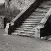
Archaeological monitoring and excavation took place on the S side of Rowallan Castle courtyard to facilitate the installation of a new soil pipe outflow system. One trench ran along the S side of the courtyard; the other was positioned within the paved area on the very southern limit of the courtyard. The work uncovered the foundations of the S range of the castle, with overlying rubble and levelling deposits providing a platform for the present courtyard. In addition, refuse deposits of 18th- and 19th-century date were identified in the SW side of the courtyard. Historic building recording included a room and stairway on the ground floor of the S range and the spiral stairwell of the SW stair tower, connecting all floors of the S range. This element of the programme consisted of rectified photography and hand-drawn survey.
Archive: NRHE
Funder: Private individual
Tudor Skinner – Addyman Archaeology
(Source: DES Vol 19)
OASIS ID: addymana1-317092


