Following the launch of trove.scot in February 2025 we are now planning the retiral of some of our webservices. Canmore will be switched off on 24th June 2025. Information about the closure can be found on the HES website: Retiral of HES web services | Historic Environment Scotland
Fordoun House
Moated Site (Medieval), Spear (Medieval)(Possible)
Site Name Fordoun House
Classification Moated Site (Medieval), Spear (Medieval)(Possible)
Canmore ID 36470
Site Number NO77NW 4
NGR NO 73543 77033
Datum OSGB36 - NGR
Permalink http://canmore.org.uk/site/36470
- Council Aberdeenshire
- Parish Fordoun
- Former Region Grampian
- Former District Kincardine And Deeside
- Former County Kincardineshire
NO77NW 4 7355 7703.
(NO 7355 7703) Moat (NR)
OS 1:10,000 map, (1978)
ROMAN CAMP (R) Spear found (NAT)
OS 6" map, Kincardineshire, 2nd ed., (1904)
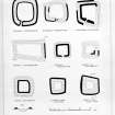
A well-preserved medieval moat 18ft wide, 6ft deep, still wet, fed by a stream which enters at the NE corner. The area enclosed measures about 83 yds by 38 yds and in 1799 a gate 22ft wide was visible very near the SW corner (Chalmers 1801) In older accounts this site figured as the 'praetorium' of a Roman camp (NO77NW 9).
In 1863 Dr C Buchan (Fourdon) had a steel spearhead found in the centre of the site. He described it as Roman and said that the finder had noted that it had been attached to a long oaken shaft, around which was an iron band bearing the word 'Agricola', since lost.
O G S Crawford 1949; Name Book 1863; G Chalmer 1801.
A moat, as described. The NE, SW and SE corners have all been mutilated. Causeways across the N and S ditches are modern. There is no trace of an entrance or interior buildings. The stream which entered at the NE corner has been filled in.
No further information about the spearhead.
Revised at 1:2500.
Visited by OS (R L) 5 December 1967.
This site is listed in an Atlas of Scottish History (McNeill and MacQueen 1996) as a moated site.
Information from RCAHMS (DE) September 1997.
(Location cited as NO 7355 7704: nominated as Site of Regional Significance).
This monument is situated in flat ground at an altitude of 73m OD.
[GRC/AAS ground photographic imagery listed].
NMRS, MS/712/35.
Field Visit (7 May 1957)
This site was included within the RCAHMS Marginal Land Survey (1950-1962), an unpublished rescue project. Site descriptions, organised by county, are available to view online - see the searchable PDF in 'Digital Items'. These vary from short notes, to lengthy and full descriptions. Contemporary plane-table surveys and inked drawings, where available, can be viewed online in most cases - see 'Digital Images'. The original typecripts, notebooks and drawings can also be viewed in the RCAHMS search room.
Information from RCAHMS (GFG) 19 July 2013.
Field Visit (February 1982)
Fordoun House NO 735 770 NO77NW 4
Situated about 250m E of Fordoun House, there is a roughly rectangular moated enclosure measuring 75m by a maximum of 42m internally; the ditch measures about 7m in breadth and is accompanied on the Eby an external bank up to 3.5mthickand 0.5m high.
RCAHMS 1982, visited February 1982
(Chalmers 1887-1902, i, 177; MS notes and plan in NMRS, RCAHMS Survey of Marginal Lands)


