
Pittengardner


Pit(S) (Period Unknown), Rig And Furrow (Medieval) - (Post Medieval), Roundhouse(S) (Prehistoric), Unenclosed Settlement (Iron Age)
Site Name Pittengardner
Classification Pit(S) (Period Unknown), Rig And Furrow (Medieval) - (Post Medieval), Roundhouse(S) (Prehistoric), Unenclosed Settlement (Iron Age)
Canmore ID 36453
Site Number NO77NW 27
NGR NO 74688 76330
Datum OSGB36 - NGR
Permalink http://canmore.org.uk/site/36453


- Council Aberdeenshire
- Parish Fordoun
- Former Region Grampian
- Former District Kincardine And Deeside
- Former County Kincardineshire
NO 7489 7637 On the 5th June 2002, an archaeological watching brief was carried out at Pittengardner, Fordoun, Kincardinshire, during the dismantling of an existing electricity pole and the erection of a new pole and the laying of its accompanying length of earth wire as part of the work on the Laurencekirk - St Cyrus 33kv lines. As the pole concerned fell within an area of crop marks indicating the existence of an extensive prehistoric settlement a watching brief was undertaken. The work was observed but no archaeological features or artefacts were evident.
Information from Mr J C Murray, 16 July 2002.
Field Visit (October 1981)
Pittengardner NO 747 763 NO77NW
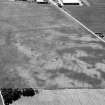
Cropmarks to the E and ESE of Pittengardner farmhouse reveal the sites of at least ten timber round-houses.
RCAHMS 1982, visited October 1981
Aerial Photographic Transcription (13 January 1994 - 20 January 1994)
An aerial transcription was produced from oblique aerial photographs. Information from Historic Environment Scotland (BM) 31 March 2017.

