Langleypark
Barrow (Prehistoric), Enclosure (Prehistoric)(Possible), Plantation Bank(S) (18th Century) - (19th Century), Rig And Furrow (Medieval) - (Post Medieval), Unenclosed Settlement (Prehistoric)
Site Name Langleypark
Classification Barrow (Prehistoric), Enclosure (Prehistoric)(Possible), Plantation Bank(S) (18th Century) - (19th Century), Rig And Furrow (Medieval) - (Post Medieval), Unenclosed Settlement (Prehistoric)
Canmore ID 35677
Site Number NO65NE 25
NGR NO 68444 59928
Datum OSGB36 - NGR
Permalink http://canmore.org.uk/site/35677
- Council Angus
- Parish Dun
- Former Region Tayside
- Former District Angus
- Former County Angus
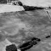
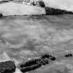
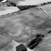
The cropmark of a small barrow, measuring about 5m in diameter has been recorded some 50m to the ESE of the enclosure as well as a number of indeterminate cropmarks scattered across the field, including a crescentic mark to the SE. An area of rig-and-furrow cultivation, aligned NNW-SSE runs across the entire field intersecting the enclosure and the barrow (NO66SE 19).
Information from RCAHMS (KJ) 19 April 2000.
Field Visit (April 1978)
Langleypark 1 NO 684 599 NO65NE
The crop-mark has been recorded of an enclosure in a level field W of Wellhill. The ditch, which measures about 5m in breadth, encloses a circular area measuring about 35m in diameter. What may be an entrance lies on the E.
RCAHMS 1978, visited April 1978


