
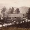
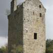
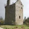
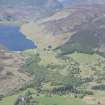
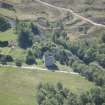
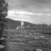
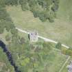
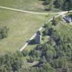
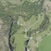
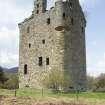
Invermark Castle


Tower House (16th Century)
Site Name Invermark Castle
Classification Tower House (16th Century)
Canmore ID 33952
Site Number NO48SW 6
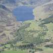
NGR NO 44222 80394
Datum OSGB36 - NGR
Permalink http://canmore.org.uk/site/33952


First 100 images shown. See the Collections panel (below) for a link to all digital images.
- Council Angus
- Parish Lochlee
- Former Region Tayside
- Former District Angus
- Former County Angus
EXTERNAL REFERENCE:
Proceedings of the Society of Antiquaries of Scotland 1933-4 - plan and 2 photographs
NMRS REFERENCE:
O'Brian Sketches. Pencil View 1817. Sketchbook missing at time of upgrade, 04.02.04
Field Visit (31 July 1958)
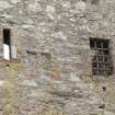
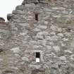
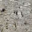
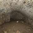
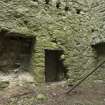
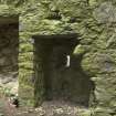
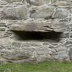
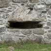
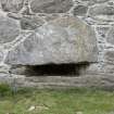
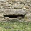
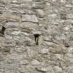
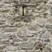
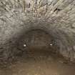
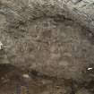
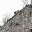
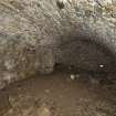
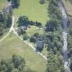
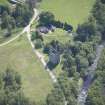
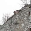
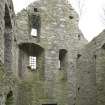
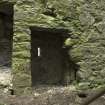
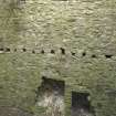
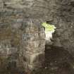
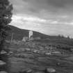
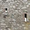
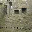
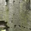
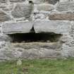
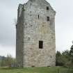
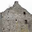
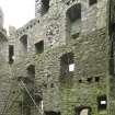
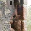
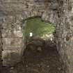
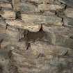
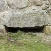
The remains of the tower which is roofless, are in good condition. The foundations to the south and east are fragmentary and may be later. They appear as a turf-covered wall spread to 1.2m and 0.2m high. The south fragment may be the foundation of the structure mentioned by Jervise in front of the entrance.
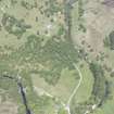
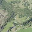
There is now only a faint suggestion of the track running west.
Visited by OS (J L D) 31 July 1958.
Two photos on record card.
Desk Based Assessment (16 July 1975)
NO48SW 6 4422 8039.
(NO 4422 8039) Invermark Castle (NR) (remains of)
OS 1/10,000 map, (1972)
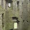
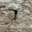
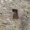
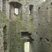
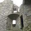
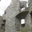
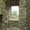
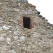
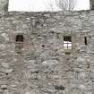
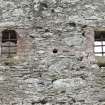
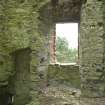
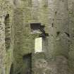
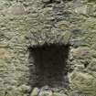
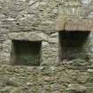
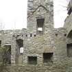
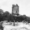
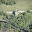
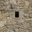
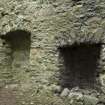
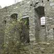
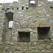
The remains of Invermark Castle now consist of a tower, 4 storeys in height and a garret, whose architectural detail suggests two periods of construction - below the second floor belongs to the first half of the 16th century and the rest to the early 17th century.
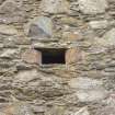
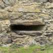
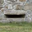
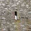
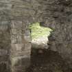
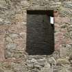
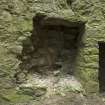
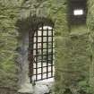
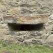
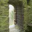
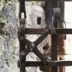
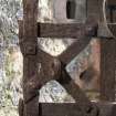
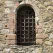
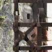
To the south and east of the tower are foundations of outbuildings, presumably the source of the material known to have been robbed from the site to build the parish church, after the castle was abandoned in 1803. The entrance to the tower, at first floor level, is a round arched doorway which retains its iron yett. Jervise (1853) suggests that the entrance was reached by means of a drawbridge which crossed a moat, and connected with an isolated platform of freestone which stood about 12' in front of the tower. He also says that part of the moat remained on the west side of the hillock on which the castle stands, but this may belong to an earlier castle known to have occupied the site in the 14th century.
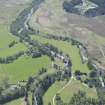
There are traces of a metalled trackway leading from the castle westwards up the bank of the river Lee, between it and the present road.
Information from OS (ES) 16 July 1975.
W D Simpson 1934; A Jervise 1853.
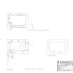
Measured Survey (29 April 2014)
RCAHMS surveyed the area immediately surrounding Invermark Castle on 29 April 2014 with plane-table and self-reducing alidade at a scale of 1:1000.

