Broch Of Culswick
Broch (Iron Age)
Site Name Broch Of Culswick
Classification Broch (Iron Age)
Canmore ID 337
Site Number HU24SE 4
NGR HU 25397 44801
Datum OSGB36 - NGR
Permalink http://canmore.org.uk/site/337
- Council Shetland Islands
- Parish Sandsting
- Former Region Shetland Islands Area
- Former District Shetland
- Former County Shetland
HU24SE 4 25397 44801
(HU 2538 4481) Brough of Culswick (NR)
OS 6" map, Shetland, 2nd ed., (1903).
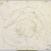
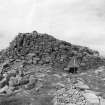
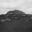
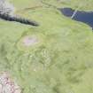
One of the best preserved brochs in Shetland, still standing to a maximum height of 15'. Although the main structure is encumbered by fallen masonry, its general outline can be clearly followed, the overall diameter being 53' and the average wall thickness 14'.
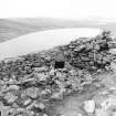
Outside, at a distance varying from 11' to 25', there has been a wall or stone revetted rampart, 13' 6" thick. Only the remains of its inner and outer faces are visible, rising to a height of 6' 6". The area between the broch and the outer defence is covered with fallen stones, some of which at least appear to be from out-buildings.
RCAHMS 1946, visited 1931.
Broch of Culswick is as described by RCAHMS.
Visited by OS (RL) 11 June 1968.
Field Visit (25 June 1931)
Broch, Culswick.
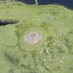
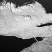
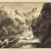
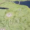
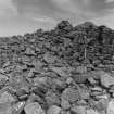
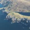
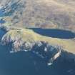
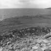
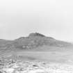
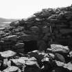
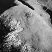
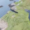
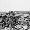
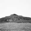
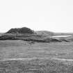
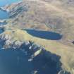
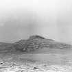
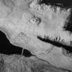
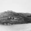
Despite great dilapidation, this broch (Fig. 590) is still one of the most impressive spectacles of the kind in Shetland, particularly as viewed from the sea. Perched upon the cliffs on the S. side of the entrance to Gruting Voe, it overlooks a wide expanse of the Atlantic Ocean. Although the main structure is much encumbered with fallen material, its general outline can be clearly followed, the over-all diameter being 53 ft. The wall has had an average thickness of some 14 ft., and in some places its outer face, which has the usual batter, is still as much as 15 ft. high. In Low's time (1774) it seems to have been 8 ft. higher (1). Outside, at a distance varying from 11 to 25 ft., there has been a wall or a stone revetted rampart, 13 ft. 6 in. thick. Only the remains of its inner and outer faces are visible, rising here and there to a height of 6 ft. 6 in. The area between the broch and the outer defence is covered with fallen stones, some of which at least appear to be from ‘outbuildings’.
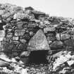
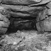
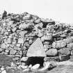
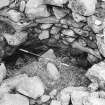
The doorway, much blocked with debris, is on the E, and its slightly converging jambs are surmounted by a massive triangular lintel (Fig. 589). The passage to which it gives access is 14 ft . 6 in. long and 3 ft . wide, and is checked on both sides for a door about midway in its length. On the right or N. side of its inner half is a chamber, not now accessible but originally entered from the courtyard. Above its inner end, and also above the entrance to the chamber, are rectangular openings in the inner face of the main wall, while at four points corbel-stones project, as at Mousa, at what must be from 9 to 10 ft. above floor-level. There are indications of a gallery or galleries on the NW and NE.
RCAHMS 1946, visited 25 June 1931.
(1) Tour, p.88
OS 6" map, Shetland, 2nd ed., (1903).
Measured Survey (23 June 1931)
RCAHMS surveyed the broch at Culswick on 23 June 1931 by plane-table and alidade. The plan was redrawn in ink and published at a reduced size (RCAHMS 1946, fig. 619).
Publication Account (2002)
HU24 3 CULSWICK ('Cullswick') HU/254448 (visited 4/6/63 and 1/7/87)
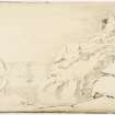
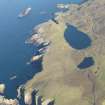
Unexcavated broch in Sandsting, with a massive and close-fitting outer wall on top of a steep, smooth knoll near cliffs and the sea (Ills. 4.6 - 4.14). This is one of the best preserved brochs in Shetland and stands on raised ground near cliffs on the south side of Gruting Voe and in the midst of rolling cultivable land; there are two freshwater lochs nearby; it has a good view out to sea (Ills. 4.6-14). Culswick was even better preserved in 1774 [3, 89]; Low's drawing (Ill. 4.143) shows three complete intra-mural galleries preserved on top of the buried basal storey as well as the scarcement ledge on the inside face. The latter is referred to as "a sort of scarcement, as if designed for flooring".
Allowing for at least 4 ft. of wall being buried at the entrance (Ills. 4.13 and 4.14) the wall seems to be preserved to a height of up to 12 ft. (Ill. 4.8) and evidently reached about 23 ft. in the 18th century [3]; it has a clear batter on the outer face (Ill. 4.8). The broch is interesting in that it is a rare example of skilful building with unsuitable stone [4]. Some vandalism had occurred to the east side in 1987.
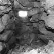
Structural analysis: The wall stands to the height of its first floor gallery; the inside face of an upper gallery can be seen above the entrance. An upper mural gallery is also visible on the wallhead at about 3 o'clock, which may have been lintelled over in 1774 [3]. There is also a void or doorway in the inner wall face at about 10 o'clock. There are no signs now of the second tier. The structure is full of debris with no sign of a scarcement ledge but a lintelled chamber is apparent over the inner end of the main entrance (Ills. 4.10 and 4.11); the lintels of the passage are not exposed here (Ill. 4.10), so if the scarcement ledge is at the level of its floor this must be concealed under debris. Four corbel stones were also noted projecting from the inner wall face [2].
The outer end of the main entrance is clear (Ill. 4.8) but debris in the passage rises to within 2 ft. of the covering lintels (Ill. 4.9). There are door-checks about 7 ft. from the exterior (they can be seen from the front in Ill. 4.9) and the outer lintel is a massive triangular stone (Ill. 4.8). A round mural cell (Ill. 4.12) is visible to the right of the main entrance, which is 14 ft. 6 ins. long [2], and is probably a tall guard cell. It is said that it "was originally entered from the courtyard" [2] but no reasons are given for this conclusion; perhaps the top of the doorway to the cell was visible in 193?.
The outer wall completely surrounds the broch though it has largely disappeared on the north side; its thickness is 13 ft. 6 ins. and the distance from the broch varies from 11-25 ft. (Ill. 4.14).
Dimensions. External diameter c. 53 ft., wall thickness averages 14 ft., walls proportion is therefore about 53%.
Sources: 1. OS card HU 24 SE 4: 2. RCAHMS 1946 vol. 3, no. 1397, 101-2 and figs. 589, 590 and 619: 3. Low 1774, 88: 4. Fojut 1982a; 5. Hibbert 1822, 453.
E W MacKie 2002


