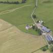
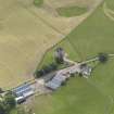
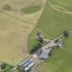
Fortar Castle
Castle (Medieval)
Site Name Fortar Castle
Classification Castle (Medieval)
Alternative Name(s) Forter Castle
Canmore ID 29403
Site Number NO16SE 8
NGR NO 18239 64640
Datum OSGB36 - NGR
Permalink http://canmore.org.uk/site/29403
- Council Angus
- Parish Glenisla
- Former Region Tayside
- Former District Angus
- Former County Angus
NO16SE 8 18239 64640.
(NO 1824 6464) Forter Castle (NR) (In Ruins)
OS 6" map, Perthshire, 2nd ed. (1902)
This castle consists of an oblong block c. 39' x 26'6" with a tower at the SE corner measuring c. 21' square, so that it is a variation of the L-plan. The entrance is in the tower, in the re-entrant angle.
Above the main stair landing - in the tower - the ceiling is vaulted. The ground floor of the main block was divided into three vaulted compartments, with a passage leading to them. One of these was the kitchen, and has an unusually large fireplace. The Hall was on the first floor with a large fireplace in the S wall, and another in the W wall. Above the Hall, there appears to have been second and third floors with an attic. On the third floors were corbelled turrets on the NE and NW angles. The castle is of the Fourth Period (1542-1700). The lands of Fortar were granted at an early date by the Durwards to the Abbey of Coupar, but afterwards passed into the hands of the Ogilvys. The castle was burnt in 1640 by the Earl of Argyll.
D MacGibbon and T Ross 1889
Fortar Castle (spelling of name confirmed) is a roofless ruin of the late 16th century, remaining generally as described and planned by MacGibbon and Ross (n.b. erroneous orientation on plan), except that vault and fireplace features have been destroyed. A circular stair turret protrudes in the re-entrant angle above the door-way on the S.
Visited by OS (JLD) 24 September 1958
Generally as described. The spelling, however, is now 'Forter' as shown on the signpost at the adjacent farm and verified by the farmer.
Visited by OS (RD) 18 July 1968
Currently being restored.
N Tranter 1990
EXTERNAL REFERENCE:
Scottish Records Office
GD 16/27/17
Contract between James, Lord Ogilvie and William Stanness, burgess and Mason of Dundie. Concerning mason work to be done.
1608


