Following the launch of trove.scot in February 2025 we are now planning the retiral of some of our webservices. Canmore will be switched off on 24th June 2025. Information about the closure can be found on the HES website: Retiral of HES web services | Historic Environment Scotland
Tomnamoine
Head Dyke (Post Medieval), Kiln Barn (Post Medieval), Still (Post Medieval)(Possible), Township (Post Medieval)
Site Name Tomnamoine
Classification Head Dyke (Post Medieval), Kiln Barn (Post Medieval), Still (Post Medieval)(Possible), Township (Post Medieval)
Alternative Name(s) Mar Lodge Estate; Glen Dee; Mar; Dubrach To East Dalvorar
Canmore ID 27750
Site Number NO08NW 4
NGR NO 0345 8940
NGR Description Centred NO 0345 8940
Datum OSGB36 - NGR
Permalink http://canmore.org.uk/site/27750
- Council Aberdeenshire
- Parish Crathie And Braemar
- Former Region Grampian
- Former District Kincardine And Deeside
- Former County Aberdeenshire
Observation (1987)
Sited on mounds and high terrace fragments at the exit of a small meltwater channel. Settlement with stone clearance heaps near the river channel to south-east. Below track, a longhouse, 20m by 5m, with adjacent circular pit 2m in diameter. Longhouse, 10m by 5m, with square enclosure 8m by 10m, tacked on, both set on a knoll. Linear stone clearance cairns. Rectangular building, 10m by 4m, with inset square 'kiln' at west end. Large stone enclosure of massive construction, around 20m square, with adjacent two-celled structure 8m by 6m. Above track, on apex of fan, a longhouse 12m by 5m, a three-partitioned longhouse 35m by 6m, and stone foundations. Head-dyke disappears within recent plantation. On knoll behind, at exit of meltwater channel, an L-shaped longhouse, 18m by 6m by 5m, with walls 1m thick.
J S Smith 1987
Field Visit (20 May 1993)
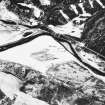
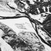
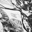
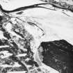
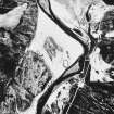
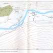
This township, which is situated on either side of the track along the N side of the River Dee immediately E of a forestry plantation, comprises six buildings, a hut, two kilns, a still and two areas of rig. A head-dyke encloses most of the township on the N and forms part of an enclosure that includes Tomnagoithe to the W (NO08NW 7).
Except for one (MAR93 171), which is rectangular and built with coursed rubble, the buildings have rounded corners and are constructed of random faced-rubble; they range in length from 6.5m to 16.4m by between 2.5m and 3.4m in breadth within walls 0.8m to 1m in thickness and standing up to 0.9m in height. The buildings display considerable individual variation or development: these include one with a stone plinth for a porch (MAR93 172), another with a wing attached to the NE end of its SE side, which is directly accessible from the main structure via a step down (MAR93 174), another with a secondary drystone partition (MAR93 170), and finally one where the original building and its extension have both been demolished to make way for a replacement (MAR93 173). The kiln of the kiln-barn is set into the slope on its W; although it is in a state of collapse, it measures about 2.2m in diameter within rubble-faced walls 1.4m in thickness with its flue opening to the ENE, where the barn extends 3m in length within walls 0.9m in thickness (MAR93 168).
The footings of what may be a still are set into the N side of a deep gully, which is cut by a small burn that runs into a boggy sump in the midst of the township buildings, and is largely hidden from view. Subrectangular in plan, the still-hut measures 4.7m from NW to SE by 2.1m transversely within embanked rubble-faced walls 1m high and 0.9m thick with an entrance in its SE end (MAR93 175).
A hut is situated on a slight terrace beside a small burn at NO 0369 8956, some 300m E of the main group of buildings; it measures 5m from E to W by 2m in breadth within rubble-faced walls 0.6m thick and standing to 0.8m in height with an entrance on the S (MAR93 381).
What may be a free-standing kiln (MAR93 298) is situated on the edge of the rigged haughland beside the River Dee some 200m S of the township buildings (NO 0356 8919); it measures 1.4m in diameter within rubble-faced walls 1.2m in thickness with an opening on the S and is abutted by a head-dyke.
There are two areas of rig in the vicinity of the township, both of about 1ha in extent: one, which lies on the haughland beside the Dee adjacent to the possible kiln (MAR93 298), is bounded by a head-dyke bank on the NW and includes several large linear clearance heaps, and the other covers the gently sloping ground on either side of the boggy sump that occupies the ground in the centre of the township buildings.
Tomnamoine is depicted as a settlement on Farquharson's map of the Forrest of Mar (1703) (National Library of Scotland), and also by Roy (Roy 1747-55), but is absent from Robertson's map of 1822.
(MAR93 168-75, 298, 381)
Visited by RCAHMS (PJD) 20 May 1993
Ground Survey (1998)
NO 033 895. Two buildings were located within a forestry plantation, close to the existing post-medieval township of Tomnamoine (NMRS NO 08 NW 4). Both structures are of drystane construction and appear to be of a similar size and build to the remains of the township.
Building 1, 9.5 x 4m, is aligned roughly N-S with an entrance in the E wall. The walls are constructed of sub-angular granite boulders (max 1m). Approximately half-way along the W wall a spur wall runs roughly E-W to join with the head dyke. The head dyke and the spur wall form a triangular enclosure; this may have been for penning animals or a small garden.
Building 2 lies c 50m NW of Building 1 on flat ground at the base of a slope. This building measures 8.6 x 4.1m and is aligned E-W with an entrance on the S side. There is a possible wind-break or apron on either side of the door. The walls survive to a maximum height of 0.6m and are constructed of sub-angular granite boulders (max 0.7m), the walls are c 0.8m thick. Adjoining this structure to the W is a possible rectangular enclosure.
Sponsor: National Trust for Scotland
S Bain 1998.
Note (22 March 1999)
Four unroofed buildings, one of which is a long building, one enclosure, one unroofed circular structure, which may be a kiln, and a head-dyke are depicted on the 1st edition of the OS 6-inch map (Aberdeenshire 1869, sheet xcvii). Six unroofed buildings, one enclosure and a head-dyke are shown on the current edition of the OS 1:10000 map (1971).
Information from RCAHMS (SAH) 22 March 1999


