
Keoldale


Rig And Furrow (Medieval)
Site Name Keoldale
Classification Rig And Furrow (Medieval)
Canmore ID 272913
Site Number NC36NE 93
NGR NC 3765 6648
NGR Description Centred NC 3765 6648
Datum OSGB36 - NGR
Permalink http://canmore.org.uk/site/272913


- Council Highland
- Parish Durness
- Former Region Highland
- Former District Sutherland
- Former County Sutherland
NC36NE 93 centred 3765 6648
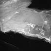
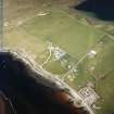
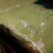
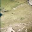
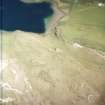
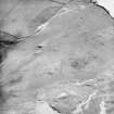
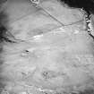
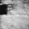
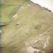
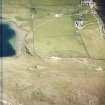
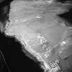
A large area of rig has been recorded on oblique aerial photography (RCAHMSAP 2004) disposed as a scatter of inter-digitating blocks on patches of flatter ground amongst the rocky outcrops and dunes between the shores of Loch Borralie and the Kyle of Durness.
Information from RCAHMS (KMM), 21 April 2005.

