
Following the launch of trove.scot in February 2025 we are now planning the retiral of some of our webservices. Canmore will be switched off on 24th June 2025. Information about the closure can be found on the HES website: Retiral of HES web services | Historic Environment Scotland
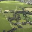
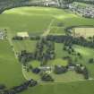
Gordon Castle, Farmsteading


Farmstead (19th Century)
Site Name Gordon Castle, Farmsteading
Classification Farmstead (19th Century)
Alternative Name(s) Gordon Castle Policies
Canmore ID 265513
Site Number NJ35NE 7.10
NGR NJ 35401 59167
Datum OSGB36 - NGR
Permalink http://canmore.org.uk/site/265513


- Council Moray
- Parish Bellie
- Former Region Grampian
- Former District Moray
- Former County Morayshire

