
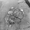
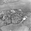
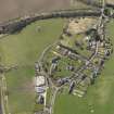
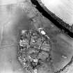
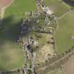
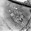
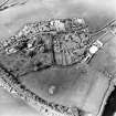
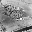
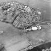
Roxburgh Parish Church, Churchyard


Churchyard (18th Century)
Site Name Roxburgh Parish Church, Churchyard
Classification Churchyard (18th Century)
Canmore ID 262033
Site Number NT73SW 261.01
NGR NT 70041 30679
NGR Description Centred 70041 30679
Datum OSGB36 - NGR
Permalink http://canmore.org.uk/site/262033


- Council Scottish Borders, The
- Parish Roxburgh
- Former Region Borders
- Former District Roxburgh
- Former County Roxburghshire
NT73SW 261.01 centred 70041 30679
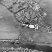
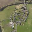
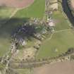
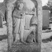
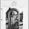
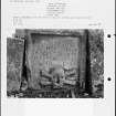
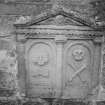
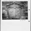
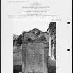
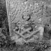
In the graveyard is the roofless burial-vault of the Kers of Chatto which was restored in 1833 and again in 1917 (information from Historic Scotlanfd listing). At least two other vaults are visible in the graveyard along with one carved gravestone (possibly of late 18th century date) which is situated on the W side, with the image of a man with his dog. Most other gravestones are of mid to late 19th and early 20th century date. A new cemetery has been built 213m NE of the church (centred NT 70189 30813).
Visited by RCAHMS (DE), 24 March 2007
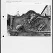
Photographic Record (1986)
Recording of gravestones in the churchyard of Roxburgh Parish Church, Roxburghshire, by Mrs Betty Willsher 1986.
Sbc Note (15 April 2016)
Visibility: Standing structure or monument.
Information from Scottish Borders Council
Sbc Note
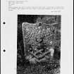
The churchyard contains:
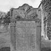
1. Small headstone of James Fairninten D. 1706.
2.Similar illegible headstone of 1706.
3.Several other similar headstones. See card (held within Scottish Borders Council Historic Environment Record).
Information from Scottish Borders Council Historic Environment Record
(n.d.)

