
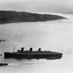
Clyde Defences, Cloch Point Battery


Hut (First World War)
Site Name Clyde Defences, Cloch Point Battery
Classification Hut (First World War)
Alternative Name(s) Cloch Lighthouse
Canmore ID 240247
Site Number NS27NW 21.02
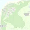
NGR NS 20498 76047
Datum OSGB36 - NGR
Permalink http://canmore.org.uk/site/240247


- Council Inverclyde
- Parish Inverkip
- Former Region Strathclyde
- Former District Inverclyde
- Former County Renfrewshire
NT27NW 21.02 20498 76047
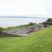
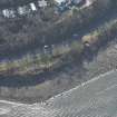
The base for a hut is situated about 240m NE of the Cloch Lighthouse. It measures about 7m by 10m and is now being used as a small picnic area. Built of brick and concrete and set into the slope above the shoreline, one metal pipe survives above the platform level.
The hut almost certainly is associated with the Cloch Searchlight Battery.
Information from Defence of Britain Project recording form, J Locock and J King, 1998
Field Visit (2 March 2016)
The concrete and brick remains of a wartime building, once part of the Cloch Battery and now an outdoor seating space, stand immediately NNW of the A770 public road and 43m ENE of a searchlight emplacement (NS27NW 21.06). Reduced to its floor level, the rectangular building measures about 18m from ENE to WSW by 5.5m transversely over a single skin of rendered brick. A doorway stood in the centre of the SSE wall and a set of steps leads up to the road level. The internal layout can be traced on the concrete floor, and there is evidence for four rooms, including a single toilet in the NE corner.
Visited by HES Survey and Recording (GG, AK, AM) 2 March 2016.

