Following the launch of trove.scot in February 2025 we are now planning the retiral of some of our webservices. Canmore will be switched off on 24th June 2025. Information about the closure can be found on the HES website: Retiral of HES web services | Historic Environment Scotland
Portknockie, Green Castle
Promontory Fort (Iron Age)
Site Name Portknockie, Green Castle
Classification Promontory Fort (Iron Age)
Canmore ID 17408
Site Number NJ46NE 8
NGR NJ 4885 6877
Datum OSGB36 - NGR
Permalink http://canmore.org.uk/site/17408
- Council Moray
- Parish Rathven
- Former Region Grampian
- Former District Moray
- Former County Banffshire
NJ46NE 8 4885 6877
(NJ 4885 6877) Green Castle (NAT)
OS 6" map, (1938).
Green Castle - a high green knowe, on the coast, bounded by steep rocky cliffs. It is traditionally recorded that a vitrified fort existed on it at one time, but there is no trace of it now remaining.
OS Name Book 1867.
The ruins of a building are to be seen at Green Castle.
Statistical Account (OSA) 1791-9.
There is no sign of antiquity on the uneven summit of Green Castle.
Visited by OS (EGC), 14 March 1962.
There are slight traces of an earthen bank bounding the S and SE sides of the flat top of Green Castle. Cliff erosion has exposed a cross-section of the bank, in which is a large quantity of charcoal, but no vitrifaction. There are no trace of buildings.
Visited by OS (RL), 17 July 1967.
NJ 489 688. Rescue excavation was undertaken in advance of erosion. The fort had a timber-laced wall, under which were traces of ploughing. The interior had been used for drying fish, and there is an extensive system of 19th century stone platforms, similar to those on neighbouring headlands. Other features included a dry-stone building with internal hearth, of late medieval date (pottery evidence), and a series of shallow pits containing some charcoal and bone but no datable material. Part of the interior was cleared to natural level and produced coarse pottery and a perforated jet ring. The timber-laced defences revealed the presence of one vertical member as well as horizontal and transversal timbers. Wall faces were difficult to identify, but the outer one probably included vertical timbers. Provisional radiocarbon dates indicate a mid-first millenium AD date for this construction. The approach causeway showed no evidence of artificial construction.
I Ralston and N Fojut 1977.
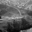
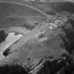
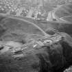
Air photographs: AAS/97/12/G27/2 and AAS/97/12/CT.
NMRS, MS/712/29.
Field Visit (14 March 1962)
There is no sign of antiquity on the uneven summit of Green Castle.
Visited by OS (EGC) 14 March 1962.
Field Visit (17 July 1967)
There are slight traces of an earthen bank bounding the S and SE sides of the flat top of Green Castle. Cliff erosion has exposed a cross-section of the bank, in which is a large quantity of charcoal, but no vitrifaction. There are no trace of buildings.
Visited by OS (RL) 17 July 1967.
Note (9 April 2015 - 25 October 2016)
Traditionally the site of a castle or vitrified fort, excavation on the promontory known as Green Castle on the seaward side of Portnockie revealed a complex history of occupation. Only short lengths of the defences were visible on the surface, but the excavation revealed a burnt timber-framed wall of early medieval date, with longitudinal beams exposed in its wall face, extending along the SE margin of the summit from the SW end overlooking the neck to enclose an area measuring a maximum of 120m from NE to SW by 30m transversely (0.28ha). This includes an area where the ground slopes down to the edge of the cliffs at the seaward end, the relatively level upper part of the summit measuring about 70m in length by 15m in breadth (0.09ha). This wall also overlay an earlier palisade trench. The entrance has not been located but is presumably towards the SW end of the SE flank. Stratified sequences of structures and floors were also excavated, the latest of which were post-medieval fish-drying platforms and a late medieval building, but at least one sub-rectangular building is probably contemporary with the defences and other floors predate them and seal earlier deposits. Some of these latter probably date from the Iron Age, but Late Bronze Age pits were also present. An extensive assemblage of artefacts was recovered, including pottery, mould fragments, jet bracelet and ring fragments, and a glass ring, and the remains of bowl furnaces were also found.
Information from An Atlas of Hillforts of Great Britain and Ireland – 25 October 2016. Atlas of Hillforts SC2945


