
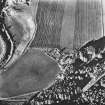
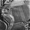
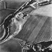
Heughhead


Farmstead (Period Unassigned), Mill (Period Unassigned)(Possible)
Site Name Heughhead
Classification Farmstead (Period Unassigned), Mill (Period Unassigned)(Possible)
Alternative Name(s) Heugh-head
Canmore ID 136569
Site Number NJ50SW 28
NGR NJ 5151 0210
Datum OSGB36 - NGR
Permalink http://canmore.org.uk/site/136569


- Council Aberdeenshire
- Parish Coull
- Former Region Grampian
- Former District Kincardine And Deeside
- Former County Aberdeenshire
NJ50SW 28 5151 0210
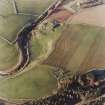
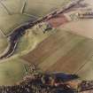
A farmstead comprising one unroofed building, one partially roofed L-shaped building, two roofed buildings, one of which is arranged around a courtyard and lies adjacent to a burn which is annotated Sluice and may therefore be a mill, and two enclosures is depicted on the 1st edition of the OS 6-inch map (Aberdeenshire 1870, sheet lxxxii). Five enclosures are shown on the current edition of the OS 1:10000 map (1972).
Information from RCAHMS (SAH) 27 April 1999.

