Lewis, Sheilavaig Mor
Farmstead (Period Unassigned)
Site Name Lewis, Sheilavaig Mor
Classification Farmstead (Period Unassigned)
Alternative Name(s) Tigh Sheilabhia Mhoir
Canmore ID 128087
Site Number NB54SW 5
NGR NB 5122 4322
Datum OSGB36 - NGR
Permalink http://canmore.org.uk/site/128087
- Council Western Isles
- Parish Stornoway
- Former Region Western Isles Islands Area
- Former District Western Isles
- Former County Ross And Cromarty
NB54SW 5 5122 4322
'The ruins of huts and a small portion of arable land...'
Name Book Book 1852. No. 38, 63
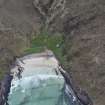
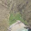
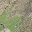
A farmstead, comprising three unroofed buildings is depicted on the 1st edition of the OS 6-inch map (Island of Lewis, Ross-shire 1852, sheet 15). Two enclosures are shown on the current edition of the OS 1:10000 map (1973).
Information from RCAHMS (AKK) 30 June 1997.


