Pricing Change
New pricing for orders of material from this site will come into place shortly. Charges for supply of digital images, digitisation on demand, prints and licensing will be altered.
Beaufort Castle
Castle (Medieval) - (Post Medieval), Chapel (Medieval) - (Post Medieval)
Site Name Beaufort Castle
Classification Castle (Medieval) - (Post Medieval), Chapel (Medieval) - (Post Medieval)
Alternative Name(s) Dounie Castle; Beauly, Beaufort Castle; Beauly Castle; Private Roman Catholic Chapel; Beaufort Castle Policies
Canmore ID 12746
Site Number NH54SW 4
NGR NH 50673 43006
Datum OSGB36 - NGR
Permalink http://canmore.org.uk/site/12746
- Council Highland
- Parish Kiltarlity And Convinth
- Former Region Highland
- Former District Inverness
- Former County Inverness-shire
NH54SW 4.00 50673 43006
(NH 5070 4298) Beau Fort {NR} (Ruin)
(NH 5063 4297) Dounie Castle {NR} (Site of)
(NH 50674301) Beaufort Castle {NAT}.
OS 25" map, Inverness-shire, 1st ed., (1871)
NH54SW 4.01 NH 50243 42480 Gardener's Cottage
NH54SW 4.02 NH 50310 42358 Walled Garden
NH54SW 4.03 NH 50313 43168 Coach House
NH54SW 4.04 NH 52149 43397 East Lodge
See also:
NH44SE 70.00 NH 49932 42166 Home Farm Steading
NH44SE 70.01 NH 49636 42208 West Lodge
Owner - Lord Lovat
Architect: James Maitland Wardrop - 1880
Groome - 1882
William Burn - 1839 (alterations and additions to previous house
Reginald Fairlie - 1938. Rebuilding after fire with additions and alterations.
NMRS
W Schomberg Scott Manuscripts MS/908 Acc No 1997/39
2 pencil drawings.
REFERENCE: National Library of Scotland
Sir Francis Linley's "Lord Lovat" - 1 plate
RIBA Drawings Collection:
William Burn 1838 & 1839 - plans for alterations & perspective sketch
REFERENCE: newscutting - 2/6/37 (J 14123 NC)
(Undated) information in NMRS.
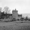
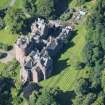
Beaufort Castle stands on the site of the old fortress of Beaufort or Downie; and mention is made of it so early as Alexander I ( 1106 - 1124) when it sustained a siege, and the trenches then made are still visible. It was also seized and blown up by Oliver Cromwell. Immediately after the battle at Culloden, it was burnt and razed to the ground by Cumberland's army. It is said that the present is the twelfth edifice which has been erected on the same site. It was the seat of the Frasers of Lovat.
New Statistical Account (NSA) 1845.
'On the North it was secured by a steep green bank, rising about 100 feet from the edge of the river: on the land side, it was guarded by two ditches, the nearest about 40 and the other about 300 yards from the walls... Traces of fortification may still be explored.
L Shaw and J F S Gordon 1882.
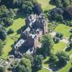
The present Beaufort Castle, seat of the Frazers of Lovat,was built in 1885 and has since been modified. The only surviving feature of Dounie Castle is part of a wall 11.0m long, 1.5m thick and 1.5m high situated at NH 5073 4300, which, according to a plaque set in a wall close by is"...the ruin of Castle Downie, the ancient stronghold of the Frazers of Lovat, built c. 1400, and destroyed by Cumberland after the battle of Culloden". The name "Downie" is undoubtedly a corruption of Dounie. Landscape gardening, in association with the modern structure, has obliterated all trace of outer defences in the west, but the ditch mentioned by Shaw is still evident in the east.
Revised at 1/2500.
Visited by OS (NKB), 17 December 1964.
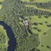
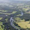
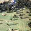
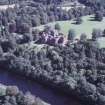
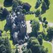
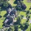
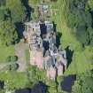
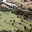
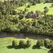
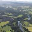
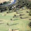
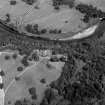
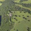
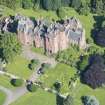
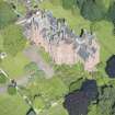
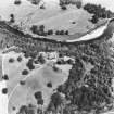
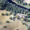
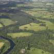
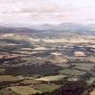
Air photographs, taken by Jill Harden in 1989, are in Inverness Museum (8904.19 and 8906.58 INVMG).
Information from J Harden, 1989.
Photographic Survey (January 1961)
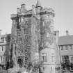
Photographic survey by the Scottish National Buildings Record in January 1961.
Field Visit (January 1978)
Beaufort Castle NH 506 430 NH54SW 4
Beaufort Castle, which has also been known as Dounie or Downie, is first mentioned in the reign of Alexander I (1106-24), and the present listed 19th-century building is one of a series which occupied the site. Immediately to the E of the mansion there is a fragment of wall, measuring 8.5m in length by at least 2m in thickness, which is said to have formed part of the castle destroyed soon after 1745; what may be a length of ditch is visible nearby.
RCAHMS 1979, visited January 1978
NSA, xiv, Inverness, 496-7; Shaw 1882, ii, 382
Watching Brief (28 August 2017)
NH 50666 43013 A watching brief was undertaken, 28 August 2017, during groundworks for a new biomass boiler and associated infrastructure. The boiler and plant room were located in an informal kitchen garden, and the pipeline crossed a lawn and landscaped grounds around the castle. The fragmentary remains of mortar and stone rubble were uncovered near the NE corner of the castle. This feature was truncated to the SE by an asbestos water pipe, and to the N by landscaping works undertaken to terrace the grounds. The pipeline trench partially truncated one end of a wall with a returning corner. The walls were constructed with mortar and boulders, with no dressed stone visible. The wall appears to be located in the area where the 1815 building is shown on the 1st Edition OS map, and the remains probably relate to this building.
Archive: NRHE
Funder: Reith Partners (Woodfuel) Ltd
Sam Williamson – AOC Archaeology Group
(Source: DES, Volume 18)


