
Unst, Blue Geos


Building(S) (Prehistoric), Midden (Period Unassigned), Unidentified Pottery (Iron Age)
Site Name Unst, Blue Geos
Classification Building(S) (Prehistoric), Midden (Period Unassigned), Unidentified Pottery (Iron Age)
Alternative Name(s) Scarf Skerry
Canmore ID 121
Site Number HP60SW 20
NGR HP 62810 04925
Datum OSGB36 - NGR
Permalink http://canmore.org.uk/site/121


- Council Shetland Islands
- Parish Unst
- Former Region Shetland Islands Area
- Former District Shetland
- Former County Shetland
HP60SW 20 6281 0492.
About four years ago Flt. Lt. M Hope found Iron Age pottery where the sea had eroded the shore to the west of Brough Taing (HP 6304) (V E Owers, Hamar, Baltasound).
At HP 6280 0492 is an occupation site heavily eroded by the sea and overlaid by a modern wall. Part of an indeterminate structure is visible defined by an arc of heavy blocks protruding through the turf, apparently the inner face of a substantial wall, with four upright stones within. A roughly oval annexe is attached to the NE, and beside a large upright stone to the E are the faint traces of a cell or recess. Others can be seen in the eroded part of the main structure.
Several potsherds of coarse, gritty ware blackened by fire were found during field investigations; one, a portion of Iron Age bead rimmed vessel, was given to Shetland Museum.
There are several field walls and cultivation terraces in the area, particularly to the S partly overlaid by modern cultivation.
Surveyed at 1/10,000.
Visited by OS (AA) 2 May 1969
Field Visit (1 May 2010)
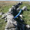
The remains of a large subcircular structure, probably a building of prehistoric date, stand above the eroding cliff edge at Blue Geos and are overlain by a dry stone wall on the W. Internally, the structure measures about 7m from ENE to WSW by at least 4.5m, but only the inner face can be identified with any degree of certainty, defined by three contiguous upright stones immediately to the E of the wall and an arc of at least seven horizontal blocks around the NE. From here, a low scarp projects the curve of the inner face SE towards the cliff edge, stopping at a large upright boulder set transversely across the thickness of the structure wall, and possibly indicating the position of an entrance. There are further upright stones, some within the interior of the structure, and another about 1m tall stands 7m to the E, though the purpose of them all is unknown. Between the wall and the three contiguous stones, there is a broken ‘pillow stone’ lying on the surface of the ground.
What appear to be the remains of an adjoining oval-shaped building lie immediately to the NE, defined by a short stretch of inner facing-stones on the SW and elsewhere by a wall reduced to a grass-grown stony bank.
Visited by RCAHMS (ARG) 1 May 2010.

