Pricing Change
New pricing for orders of material from this site will come into place shortly. Charges for supply of digital images, digitisation on demand, prints and licensing will be altered.
Corran, General
Village (Period Unassigned)
Site Name Corran, General
Classification Village (Period Unassigned)
Alternative Name(s) Arnisdale, Corran Village
Canmore ID 117937
Site Number NG80NE 7
NGR NG 85032 09303
NGR Description Centred NG 85032 09303
Datum OSGB36 - NGR
Permalink http://canmore.org.uk/site/117937
- Council Highland
- Parish Glenelg (Skye And Lochalsh)
- Former Region Highland
- Former District Skye And Lochalsh
- Former County Inverness-shire
Corran
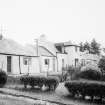
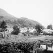
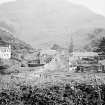
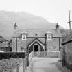
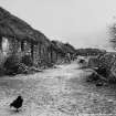
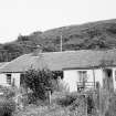
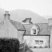
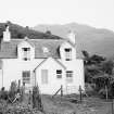
An excellent survival of a small fishing village beside the alder-fringed mouth of the Arnisdale, Corran is shown as a settlement on Roy's map of 1750. By 1836, a population of some 600 fishing folk was recorded, but the fishing was in decline and emigration had already begun. In his Survey and Report of 1803, Telford suggested that government sponsored fishing villages should take as their model the principles laid down and practised so successfully here, and in 1887 Alexander Ross praised Hugh Stevenson of the Oban family of masons/entrepreneurial building contractors (working in Oban in the 1780s-90s) for having 'established and practised so successfully a fishing settlement at Arnisdale'. This probably referred to Corran, whose principal feature today is a trio of thick-walled singlestorey whitewashed terraces (some cottages later heightened), laid out in linear plan above the tidal river estuary. They replaced the row along the shoreline shown in the photograph below of c.1890. A row of 13 (originally more) partly derelict cattle byres with shared cobbled lane and drainage ditch runs up the slope at right angles. Slightly angled along the beach is a matching row of 11 drystone sheds/fishing stores, their thatched roofs now replaced with tin. Improvements in the 1890s by Robert Birkbeck (owner of Arnisdale and Kinlochhourn from 1890) probably included re-roofing the cottages in slate. The former post office survives from the original village layout.
[The British Fisheries Society earmarked but did not pursue a development here in the 1780s - 'Though Loch Urn has a capital herring fisher, it has no other recommendation as a proper station for a town. The hills rise to a great height on both sides, and all intercourse with the inland country is nearly cut off ...'.]
Taken from "Western Seaboard: An Illustrated Architectural Guide", by Mary Miers, 2008. Published by the Rutland Press http://www.rias.org.uk
NG80NE 7 centred 85032 09303
Extends onto map sheet NG80NW.
NG80NE 850 093
Note that half of Corran lies on Mapsheet NG80NW; unlocated buildings have been assigned to the NE at present (which is the denser half of the settlement) until they can be located precisely.
Source: O/S 1:2500 Map, 1969.
(Undated) information in NMRS.
(NG 850 093) Early/mid 19th century, row of 4 single storey cottages, 3 bays with centre doors.
(NG 850 093) Mid/later19th century. Continuous row of 13 single storey byres sharing cobbled frontage and common drain. Vary slightly in size.
(NG 849 093) Early/mid 19th century continuous single storey 12 bay row of 11 drystone fishing stores, the end store (west) being slightly larger with small window.
Information from HBD list, Glenelg parish items 3-5
A village, comprising seven roofed and two partially roofed buildings is depicted on the 1st edition of the OS 6-inch map (Inverness-shire 1876, sheet lxxvii). These buildings are formed of a row of fishing stores, a row of byres and at least three rows of dwellings.
Seven roofed buildings, three of which are rows of cottages and one partially roofed buildings are shown on the current edition of the OS 1:10000 map (1971).
Information from RCAHMS (AKK), 31 July 1996.


