
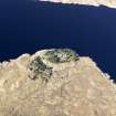
Loch Clunie


Building (Period Unassigned)
Site Name Loch Clunie
Classification Building (Period Unassigned)
Canmore ID 109748
Site Number NH01SE 10
NGR NH 098 111
Datum OSGB36 - NGR
Permalink http://canmore.org.uk/site/109748

- Council Highland
- Parish Glenshiel
- Former Region Highland
- Former District Skye And Lochalsh
- Former County Ross And Cromarty
Note
A single unroofed building is depicted on the 1st edition of the OS 6-inch map (Ross-shire 1880, sheet cxxxiii). With the raising of Loch Clunie by a hydro-electric scheme the site has been submerged and is therefore not shown on the current edition of the OS 1:10000 map (1971).
Information from RCAHMS (AKK) 9 May 1996

