Field Visit
Date 17 March 2009
Event ID 579840
Category Recording
Type Field Visit
Permalink http://canmore.org.uk/event/579840
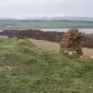
The heavily robbed remains of Kelspoke Castle and adjacent farmstead of North Kelspoke are situated on a small knoll 450m NW of South Kelspoke, with extensive views to the N, S and E. The castle remnants include a length of dressed and mortared red sandstone wall, which tops a low scarp. This stretch of wall measures over 12m from NW to SE and is 0.9m in thickness and up to 1m in height at the S end where it returns to the SW. There are the grass-grown footings of at least three buildings and a subrectangular enclosure to the SW of the castle. The farm of 'North Kelsbog' is shown on Roy’s Military Map (1747-55) and a Foulis estate map (1758-90), (RHP 14107/3) where the site is depicted as four buildings, one of which is L-plan, and two adjacent enclosures. To the S of the farmstead is an area depicted as meadow by Foulis.
Visited by RCAHMS (AGCH, IP) 17 March 2009.


