North Berwick Law Archaeological Survey


Date February 2018 - January 2019
Event ID 1035693
Category Project
Type Project
Permalink http://canmore.org.uk/event/1035693
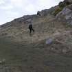
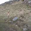
An archaeological survey of North Berwick Law was undertaken by HES Survey and Recording in 2018 at the behest of East Lothian Council. The initial phase of fieldwork included the collection of high resolution oblique aerial photographs and dGPS ground control in order to facilitate the production of a 20cm resolution image-based model. A second phase involved the analysis of that model, and collection of dGPS data for each archaeological feature over 8 days of fieldwork. Notes were collated for 76 features in an Access database (HES Archive: WP005305), and written descriptions were created for 37 sites or groups. Each description was peer-reviewed before entry into Canmore, and a site-area polygon was created for all individual entries. Detailed plans of the signal station and observation post were prepared, as well as an overall site plan at 1:1000 presented in various formats including a PDF with overlays from other datasets, and links to site records (WP005412). The project built on the results of a previous survey by Headland Archaeology Ltd in 2000 (MS1039/72), expanding on their numbering sequence.
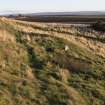
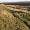
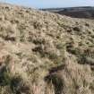
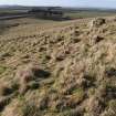
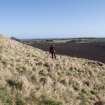
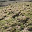
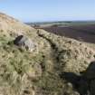
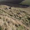
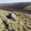
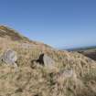
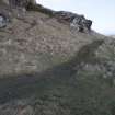
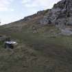
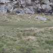
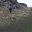
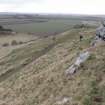
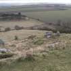
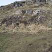
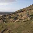
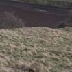
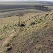
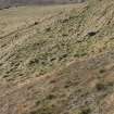
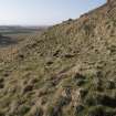
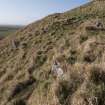
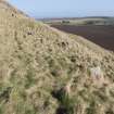
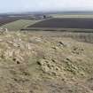
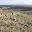
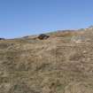
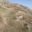
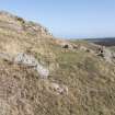
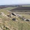
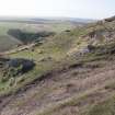
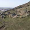
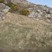
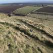
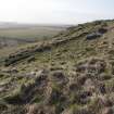
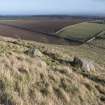
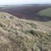
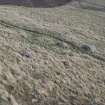
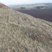
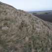
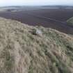
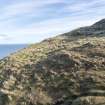
The earliest features on North Berwick Law comprise a pair of newly discovered cup-marked rocks and the scanty remains of a prehistoric hilltop fort discovered by RCAHMS (1957, xv), whose outworks appear to be more limited than suggested by previous authorities (Feachem 1963, 119; OS 1975). The lower SW flank of the Law is dotted with the remains of a prehistoric settlement comprising at least 12 hut circles or house platforms and fragments of an associated field system of small cairns and banks. This field system is truncated along its southern edge by later cultivation, and at the foot of the hill by the now disused Law Quarry. Further evidence for quarrying was found along the NW foot of the hill. An indication of the date of the fort and settlement is limited to stray Bronze Age finds recovered in the 19th and 20th century.
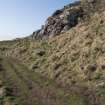
The NE and SE flanks retain a few ash and beech trees which form part of a plantation established by Sir Hew Dalrymple (1652—1737) to celebrate the Treaty of Union in 1707. Though fragments of a plantation bank were recognised in 2000, it encloses a larger area than recognised and features a decorative roundel at its NE extremity. A large bank which runs across the S slope of the hill, and another along the W, may be part of the same, or a related, scheme.
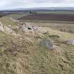
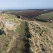
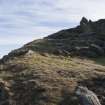
The summit of the Law hosts the remains of an Admiralty Coastal Signal Station of 1798—1814 (Morris and Barclay 2017) which includes at least five structures (the best preserved of which is a small accommodation block), as well as a zig-zag path which heads down the steep NE flank of the hill – once known as the M-walk (OS Name Book No. 25, 67). A second well-preserved building is a military observation post dating from 1933 or before (Ferrier 1980, 63). To these can be added a triangulation pillar, a commemorative monument and the famous whalebone arch, the last of which has stood at the site since at least 1789 (Redman 2004), though the present arch is a recent fibreglass replacement.
The opportunity was taken to record other nearby features during the survey, including a curling pond to the NE of the hill, the former site of the North Berwick Water Works to the W, and an area of rig-and-furrow cultivation to the S.
Visited by HES Survey and Recording (GFG, JRS, LB, AM) 19-23 February 2018, (GFG, ATW, AM, SZ) 3 May 2018, (GFG, JRS, AM) 13 September 2018, and (GFG, LB, DCC) 13 November 2018.


![Signal Station. Inscription of G R [Georgius Rex].](http://i.rcahms.gov.uk/canmore/l/DP00281306.jpg)


![Signal Station. Inscription of G R [Georgius Rex].](http://i.rcahms.gov.uk/canmore/s/DP00281306.jpg)