Sortie 2016/02
551 500/1/1/2/2
Description Sortie 2016/02
Date 15/1/2016
Collection Historic Environment Scotland
Catalogue Number 551 500/1/1/2/2
Category All Other
Permalink http://canmore.org.uk/collection/1509784
Description Sortie 2016/02
Date 15/1/2016
Collection Historic Environment Scotland
Catalogue Number 551 500/1/1/2/2
Category All Other
Permalink http://canmore.org.uk/collection/1509784
Collection Level (551 500) Historic Environment Scotland
> Group Level (551 500/1) Survey and Recording Programmes
>> Sub-Group Level (551 500/1/1) Aerial Survey Programme
>>> Sub-Group Level (551 500/1/1/2) 2016 photographs
>>>> Sub-Group Level (551 500/1/1/2/2) Sortie 2016/02
| Preview | Category | Catalogue Number | Title | Date | Level |
|---|---|---|---|---|---|
 |
On-line Digital Images | DP 229047 | Oblique aerial view of the farmstead, field system and rig at Carim Cottage, looking NW. | 15/1/2016 | Item Level |
 |
On-line Digital Images | DP 229048 | Oblique aerial view of the field system and rig at Tambeth, looking N. | 15/1/2016 | Item Level |
 |
On-line Digital Images | DP 229049 | Oblique aerial view of the farmstead, field system and rig at Upper Glendevon Reservoir, looking W. | 15/1/2016 | Item Level |
 |
On-line Digital Images | DP 229050 | General oblique aerial view centred on Gleneagles House, looking NNW. | 15/1/2016 | Item Level |
 |
On-line Digital Images | DP 229051 | Oblique aerial view of the enclosures at Black Maller, looking W. | 15/1/2016 | Item Level |
 |
On-line Digital Images | DP 229052 | Oblique aerial view of the enclosures at Black Maller, looking W. | 15/1/2016 | Item Level |
 |
On-line Digital Images | DP 229053 | Oblique aerial view of the enclosure at John's Hill, looking SE. | 15/1/2016 | Item Level |
 |
On-line Digital Images | DP 229054 | Oblique aerial view of the enclosure at John's Hill, looking SE. | 15/1/2016 | Item Level |
 |
On-line Digital Images | DP 229055 | Oblique aerial view of the enclosure at John's Hill, looking ENE. | 15/1/2016 | Item Level |
 |
On-line Digital Images | DP 229056 | Oblique aerial view of the enclosure at John's Hill, looking NW. | 15/1/2016 | Item Level |
 |
On-line Digital Images | DP 229057 | Oblique aerial view of the township, field system and hut circle at Corb Glen, looking NW. | 15/1/2016 | Item Level |
 |
On-line Digital Images | DP 229058 | Oblique aerial view of the township, field system and hut circle at Corb Glen, looking WNW. | 15/1/2016 | Item Level |
 |
On-line Digital Images | DP 229059 | Oblique aerial view of the tracks at Scores Burn, looking SW. | 15/1/2016 | Item Level |
 |
On-line Digital Images | DP 229060 | Oblique aerial view of the farmstead and tracks at Corb and Scores Burn, looking S. | 15/1/2016 | Item Level |
 |
On-line Digital Images | DP 229061 | Oblique aerial view of the tracks at Scores Burn, looking SSW. | 15/1/2016 | Item Level |
 |
On-line Digital Images | DP 229062 | Oblique aerial view of the tracks at Scores Burn, looking SSW. | 15/1/2016 | Item Level |
 |
On-line Digital Images | DP 229063 | Oblique aerial view of Rossie Law fort, looking WSW. | 15/1/2016 | Item Level |
 |
On-line Digital Images | DP 229064 | Oblique aerial view of the farmstead, enclosures and rig at Scores Burn, looking S. | 15/1/2016 | Item Level |
 |
On-line Digital Images | DP 229065 | Oblique aerial view of the farmstead, enclosures and rig at Scores Burn, looking SSE. | 15/1/2016 | Item Level |
 |
On-line Digital Images | DP 229066 | Oblique aerial view of Castle Law fort, looking NW. | 15/1/2016 | Item Level |
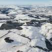 |
On-line Digital Images | DP 229067 | General oblique aerial view with Castle Law fort in the foreground and Dunning beyond, looking W. | 15/1/2016 | Item Level |
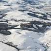 |
On-line Digital Images | DP 229068 | General oblique aerial view with Castle Law fort in the foreground and Dunning beyond, looking W. | 15/1/2016 | Item Level |
 |
On-line Digital Images | DP 229069 | Oblique aerial view of the field boundaries at Balmano Hill, looking ENE. | 15/1/2016 | Item Level |
 |
On-line Digital Images | DP 229070 | Oblique aerial view of the field boundaries at Balmano Hill, looking ENE. | 15/1/2016 | Item Level |

© Historic Environment Scotland. Scottish Charity No. SC045925