
Pricing Change
New pricing for orders of material from this site will come into place shortly. Charges for supply of digital images, digitisation on demand, prints and licensing will be altered.
Gillesbie Tower


Earthwork (Medieval), Tower House (15th Century)
Site Name Gillesbie Tower
Classification Earthwork (Medieval), Tower House (15th Century)
Alternative Name(s) Gilsbie
Canmore ID 66945
Site Number NY19SE 6
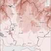
NGR NY 17176 91934
Datum OSGB36 - NGR
Permalink http://canmore.org.uk/site/66945


- Council Dumfries And Galloway
- Parish Hutton And Corrie
- Former Region Dumfries And Galloway
- Former District Annandale And Eskdale
- Former County Dumfries-shire
NY19SE 6 1717 9192.
(NY 1717 9192) Gillesbie Tower (NR) (Remains of)
OS 6" map, (1958)
See also NY19SE 33 Upper Fenton, Architectural Fragments
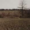
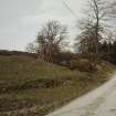
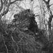
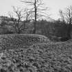
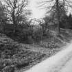
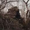
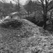
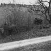
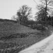
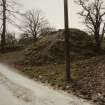
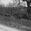
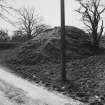
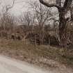
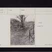
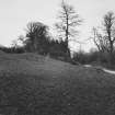
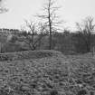
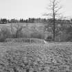
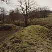
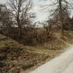
Fragmentary remains of a probably 16th century stronghold originally some 41' by 35', with walls about 6' thick. An earthen rampart with outer ditch, which formed an arc from the steep river bank on the E round the tower to the bank again, has been cut through by a modern road.
RCAHMS 1920
In a map of c. 1590 'Gilsbie' tower is shown E of the River Annan.
Burghley c. 1590
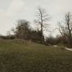
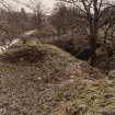
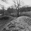
The tower measures overall 9.0m NW-SE by 12.5m transversely with walling 2.0m thick and in the SE corner 5.5m high. The interior is heavily overgrown and walling unsafe, but in the SE is a well-preserved garderobe. The court measures c. 25m NE-SW by c. 20m transversely, the enclosing rampart remaining to a maximum height of 2.2m while the ditch is 2.6m deep.
Name confirmed.
Resurveyed at 1:2500.
Visited by OS (D W R) 7 December 1971
Measured Survey (15 May 1990)
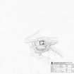
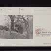
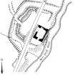
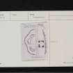
RCAHMS surveyed the earthwork and tower house at Gillesbie Tower on 15 May 1990 with plane-table and self-reducing alidade at a scale of 1:500. The plan was redrawn in ink and published at a scale of 1:1000 (RCAHMS 1997, Fig. 209).
Field Visit (15 May 1990)
NY 1717 9192 NY19SE 6
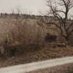
On the right bank of the Dryfe Water, there are the remains of a 16th-century tower-house. It stands to first-floor level, has round-chamfered external angles, and a garderobe chute, descending from second-floor level, in the S angle. The interior is choked with debris but measures 12.2m from SW to NE by 9.3m transversely over walls up to 1.9m in thickness. The tower, which is set side-on to the river-cliff, occupies the S portion of a D-shaped enclosure defined by a ditch up to 5m broad and 2.6m deep. On the N, there is an inner bank (up to 5m thick and 3.2m high), remodelled at least once, which has been truncated by the public road that transects the site. A medial cut across the bank is probably the result of modern disturbance but may be on the site of an original entrance. Beside the ditch, to the NE of the tower, a rubble spread suggests the provision of a wall to continue the line of the bank.
The earthwork possibly predates the tower. For a number of architectural fragments which may have come from the tower see NY19SE 33. Gillesbie is on record in 1486 and was the property of the Grahams.
Visited by RCAHMS (IMS) 15 May 1990.
Listed as tower and earthwork.
RCAHMS 1997.
Field Visit (1996 - 2003)
Russell Coleman managed an Historic Scotland funded project to record medieval moated sites in Scotland. Gazetteers were produced for each regional council area between 1996 and 2002 with an uncompleted overall review in 2002-03. The results of the first year of the project were published in Tayside and Fife Archaeological Journal, Volume 3 (1997).

