Pricing Change
New pricing for orders of material from this site will come into place shortly. Charges for supply of digital images, digitisation on demand, prints and licensing will be altered.
Upcoming Maintenance
Please be advised that this website will undergo scheduled maintenance on the following dates:
Thursday, 9 January: 11:00 AM - 3:00 PM
Thursday, 23 January: 11:00 AM - 3:00 PM
Thursday, 30 January: 11:00 AM - 3:00 PM
During these times, some functionality such as image purchasing may be temporarily unavailable. We apologise for any inconvenience this may cause.
Dumfries, Heathhall Airfield, Edinburgh Road, L Type Aircraft Hangars
Aircraft Hangar(S) (20th Century)
Site Name Dumfries, Heathhall Airfield, Edinburgh Road, L Type Aircraft Hangars
Classification Aircraft Hangar(S) (20th Century)
Alternative Name(s) Raf Dumfries
Canmore ID 85561
Site Number NX97NE 153.02
NGR NX 99361 79880
NGR Description NX 99361 79880, NY 99334 80097 and NY 99479 80168
Datum OSGB36 - NGR
Permalink http://canmore.org.uk/site/85561
- Council Dumfries And Galloway
- Parish Dumfries
- Former Region Dumfries And Galloway
- Former District Nithsdale
- Former County Dumfries-shire
NX97NE 153.02 99361 79880 and NY 99334 80097 and 99479 80168
Extends to map sheet NX98SE
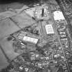
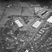
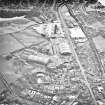
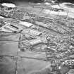
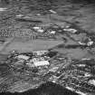
A type L aircraft hangar was situated on the N side of Heathhhall Airfield at Locharbriggs. The building (NX 99361 79880) would appear to have been removed as it is shown as a blank space on the current OS 1:2500 scale digital map. Two further L type aircraft hangars lie to the 134m and 235m to the N respectively (NY 99334 80097 and NY 99479 80168) and are now factory units with additions.
The aircraft hangar is visible on large scale 1:5000 vertical air photographs (106G/UK 1314, 5030-5031, flown 27 March 1946), along with a possible two other of the same type all of which have now been removed.
The hangars are visible on RAF WW II vertical air photographs (FNO 158, 6.3-6.4, flown 26 September 1942), which show that at that date they had been covered with camouflage netting.
Type L aircraft sheds were designed to for Aircraft Servcing Unit airfields (ASU) for the maintenance and storage of aircraft. Built by the Teeside Bridge and Engineering Company after 1939. They were simliar to the Type E, but with steel reinforced concrete arched roofs and end walls. Earth covering was normally used and secured with mesh wire. They have a span of over 55m and length is 100m (P Francis1996).
Information from RCAHMS (DE), April 2006.


