Scheduled Maintenance
Please be advised that this website will undergo scheduled maintenance on the following dates: •
Tuesday 3rd December 11:00-15:00
During these times, some services may be temporarily unavailable. We apologise for any inconvenience this may cause.
Loch Arthur
Crannog (Period Unassigned), Logboat (Possible)
Site Name Loch Arthur
Classification Crannog (Period Unassigned), Logboat (Possible)
Alternative Name(s) Loch Arthur 2; Beeswing
Canmore ID 65468
Site Number NX96NW 1
NGR NX 9028 6898
Datum OSGB36 - NGR
Permalink http://canmore.org.uk/site/65468
- Council Dumfries And Galloway
- Parish New Abbey
- Former Region Dumfries And Galloway
- Former District Nithsdale
- Former County Kirkcudbrightshire
NX96NW 1 9028 6898
For logboat (Loch Arthur 1) found in 1874 at NX c. 905 687, see NX96NW 3.
(NX 9028 6898) Lake Dwelling (NR)
OS 6" map (1957)
This crannog was first noted in 1874 when the level of Loch Arthur was exceptionally low. At that time it was described as about 100 ft in diameter, approached by a stone causeway about 30 yds long. The remains of 'oaken piles driven in in rows, with horizontal beams between' could be traced in the water round the NE and S sides. The lines of two small enclosures could be traced on the S side of the crannog. It was also noted that ashes and other signs of fire were found here many years before 1874.
J E Gillespie 1876
When field investigated in 1964, no traces of any oak piles or beams were seen, nor were any structures found, though quantities of loose stones lay on the surface. The causeway was not located, the area between the crannog and the mainland, covered with head-high grass, having been used as a refuse dump. Probing was inconclusive.
Surveyed at 1:2500.
Visited by OS (WDJ) 6 July 1964
A series of small exploratory excavations were carried out here by J Williams and A E Truckell in 1966-7. Timbers were visible on the SE edge of the crannog (B on plan) where a possible fragment of a dug-out canoe was also observed. Walls from 2 1/2 ft to 3 ft thick, standing about 1 1/2 ft high, were noted; judging from the rubble surrounding these footings, the walls must originally have stood about 3 ft high and probably represent the stone undercroft of a wooden framed building. The main building, oriented N-S, measures internally 35 ft by 15 ft; there is an annexe to the W. The paved and raised structure at A on plan may be the remains of a small jetty. Apart from the late medieval tripod pots described on NX96NW 2, no material has been recovered by which this crannog can be dated. (However, see also NX96NW 3.)
A small Mesolithic flint was recovered from the soil at 'D'.
J Williams 1971
Listed among a number of crannogs examined, and from which timber samples were taken on behalf of, and funded by SDD (HBM).
T N Dixon 1989c.
(Loch Arthur 2). In 1966-7 archaeological survey revealed a 'possible fragment of a dug-out canoe' on the SE side of the crannog in Loch Arthur and about 15m SSW of the remains of a possible jetty. This object was apparently left in situ but was not re-located in August 1992 during further underwater survey (by Niall Gregory).
J Williams 1971; R J C Mowat 1996; Information from Mr N Gregory.
As the underwater component of Phase 2 of the South West Crannog Survey, the state of preservation of 14 crannog sites was evaluated in 12 lochs throughout Dumfries and Galloway as part of the Scottish Wetland Archaeology Programme (SWAP).
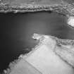
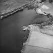
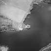
NX 9028 6898. The tree-covered island visible at this site is off-centre from the main mound, the majority of the site being underwater to the S and W of the island and at least 25m in diameter. Many timbers were immediately visible, including substantial oak piles up to a diameter of c 25cm. Several large oak horizontals were noted on the top of the main submerged mound, on average c 30-40cm across and c 2m long, apparently arranged radially from the centre of the site. Over 30 oak piles were noted. Organic deposits consisting of partially degraded plant material, bracken and twigs were noted eroding from the edges of the site on the E and SE sides. Most of the exposed timbers were covered by aquatic plants and algae which appear to be accelerating their degradation.
Sponsors: HS, Scottish Trust for Archaeological Research, AOC Archaeology Group, University of Nottingham
M G Cavers and J C Henderson 2002.
The second season of the South West Crannog Survey Phase 2 was carried out in September 2003 (DES 2002, 25-7) and comprised detailed digital survey of submerged and dry areas of selected crannog sites in Dumfries and Galloway. Small-scale underwater excavations were also carried out in order to stabilise and record exposed eroding timbers. The project was conducted by the Underwater Archaeology Research Centre as part of the Scottish Wetland Archaeology Programme (SWAP).
NX 9028 6898. Underwater excavations were carried out on the submerged portion of Loch Arthur in order to stabilise and record eroding sections noted in 2002 (DES 2002, 26). Trench 1 recorded the timbers eroding out of the submerged mound at the S side of the crannog; over 70 alder timbers were drawn and photographed in situ. These timbers were arranged in horizontal layers, each layer at approximately 33o to the layer below, in a matrix of twigs and comminuted brushwood material containing hazelnuts, woodchips, and many fire-cracked stones. A perforated stone was recovered from an unstratified context in this area. No vertical piles were present in this area of the site.
Trench 2 was placed over several large exposed horizontal alder timbers on the flat area of the submerged mound, towards the SE corner of the site. A layer of boulders and stones was cleared from around the eroding timbers and the underlying horizontals were planned. Excavation of a 2 x 2m area around the exposed timbers encountered a deposit of comminuted plant matter as well as broken down twigs and fire-cracked stones. This deposit also contained many woodchips showing tool facets. Several of the large timbers had mortise joints cut through them, though there was no evidence of any tenon or other structural purpose of these joints. No other artefacts were recovered in this area, and undisturbed loch bed marl was encountered at just over 1m from the surface of the mound.
A 2 x 1m trial trench opened on the dry area of the crannog to record the sediment profile in desiccated areas and to investigate the potential for organic preservation. Beneath a deep layer of rounded boulders in a soil matrix were parallel roundwood alder timbers, resembling a floor layer. A sherd of medieval green-glazed pottery was recovered from the boulder layer.
A detailed survey of the crannog was carried out. Geophysical survey was carried out on the shore adjacent to the site, though with inconclusive results.
Full report to be lodged with the NMRS.
Sponsors: HS, Scottish Trust for Archaeological Research, Nottingham University, AOC Archaeology Group.
M G Cavers and J C Henderson 2003.
Loch Arthur (New Abbey catchment): location cited as NX 9028 6898.
This crannog was first noted in 1874, when the level of the loch was exceptionally low. Small exploratory excavations in 1976-7 revealed possible medieval structures. The site was dived in 1989, and two piles sampled for radiocarbon dating, which indicated Iron Age activity. Dates of 2260 +/- 50 bp [310 bc] (GU-2643) and 2240 +/- 60 bp [290 bc] (GU-2644) were obtained. Part of a logboat was recorded in 1976-7, but could not be relocated in August 1992 during diving by Niall Gregory.
The remains of this crannog were surveyed in July 2002 during the 2nd phase of the South-West Scotland Crannog Survey, with the intention of establishing an effective system of monitoring the rate of organic decay. In view of the threat from wave erosion and biological action, it was recommended for continued monitoring.
This crannog survives as an island, on which grow mature oak and beech trees. Underwater observation revealed that most of the monument lies underwater, as the visible island projects off-centre above a much larger mound. The two structures are distinguished by their composition, the exposed upper mound being primarily of large boulders and soil while the lower mound comprises timber, organic deposits and stones. This mound may be of medieval origin.
The lower mound measures at least 25m in diameter and extends further into the loch to the E of the island; its upper surface lies only 0.3m below the water level. Both horizontal and vertical timbers are visible throughout this mound, the former being apparently arranged radially from the centre. About 30 piles (measuring between about 0.13 and 0.2m in diameter) were noted around the W side. Rich organic deposits (incorporating bracken, twigs and comminuted plant remains) were exposed across the upper surface of the lower mound.
Most of the exposed timbers are covered in vegetation, which is apparently accelerating their erosion. The condition of the timbers varies greatly, some being in an advanced state of decay. This process is evidently continuing on the lower mound, possibly because its shallow depth allows photosynthesis. Wave-generated erosion is also exposing timbers in a section on the SE.
The underwater visibility was about 3m, the best noted during the survey programme.
[The logboat noted by Gregory was apparently not seen].
J C Henderson, B A Crone and M G Cavers 2003.
A third season of fieldwork and survey (see DES 2003, 42-3) on selected crannog sites in Dumfries and Galloway was carried out in July 2004 as part of the Scottish Wetland Archaeology Programme (SWAP). This comprised the underwater examination of six crannog sites selected for monitoring, the installation and surveying of monitoring probes at those sites, and the sampling of timbers from Loch Heron for radiocarbon dating.
NX 1206 6047 Cults Loch (Inch parish), NX16SW 14.
NX 2717 6482 Loch Heron (Kirkcowan parish), NX26SE 2.
NX 9028 6898 Loch Arthur (New Abbey parish), NX96NW 1.
NX 2047 5631 Whitefield Loch (Old Luce parish), NX25NW 7.
NX 2595 5915 Barhapple Loch (Old Luce parish), NX25NE 2.
NX 2047 5631 Barlockhart (Old Luce parish), NX25NW 7.
NX 8388 7188 Milton Loch (Urr parish), NX87SW 4.
Sponsors:HS, Scottish Trust for Archaeological Research, University of Nottingham, AOC Archaeology Group, Underwater Archaeology Research Centre.
J Henderson and M G Cavers 2004.
Excavation (1966 - 1967)
A series of small exploratory excavations were carried out here by J Williams and A E Truckell in 1966-7. Timbers were visible on the SE edge of the crannog (B on plan) where a possible fragment of a dug-out canoe was also observed. Walls from 2 1/2 ft to 3 ft thick, standing about 1 1/2 ft high, were noted; judging from the rubble surrounding these footings, the walls must originally have stood about 3 ft high and probably represent the stone undercroft of a wooden framed building. The main building, oriented N-S, measures internally 35 ft by 15 ft; there is an annexe to the W. The paved and raised structure at A on plan may be the remains of a small jetty. Apart from the late medieval tripod pots described on NX 96 NW 2, no material has been recovered by which this crannog can be dated. (However, see also NX 96 NW 3.)
A small Mesolithic flint was recovered from the soil at 'D'.
J Williams 1971
Diver Inspection (July 2004 - July 2004)
A third season of fieldwork and survey (see DES 2003, 42-3) on selected crannog sites in Dumfries and Galloway was carried out in July 2004 as part of the Scottish Wetland Archaeology Programme (SWAP). This comprised the underwater examination of six crannog sites selected for monitoring, the installation and surveying of monitoring probes at those sites, and the sampling of timbers from Loch Heron for radiocarbon dating.
NX 1206 6047 Cults Loch (Inch parish), NX16SW 14.
NX 2717 6482 Loch Heron (Kirkcowan parish), NX26SE 2.
NX 9028 6898 Loch Arthur (New Abbey parish), NX96NW 1.
NX 2047 5631 Whitefield Loch (Old Luce parish), NX25NW 7.
NX 2595 5915 Barhapple Loch (Old Luce parish), NX25NE 2.
NX 2047 5631 Barlockhart (Old Luce parish), NX25NW 7.
NX 8388 7188 Milton Loch (Urr parish), NX87SW 4.
Sponsors: HS, Scottish Trust for Archaeological Research, University of Nottingham, AOC Archaeology Group, Underwater Archaeology Research Centre.
J Henderson and M G Cavers 2004.


