
Cliftoncote


Farmstead (Post Medieval), Settlement (Medieval)
Site Name Cliftoncote
Classification Farmstead (Post Medieval), Settlement (Medieval)
Alternative Name(s) Clifton Cot; Cliftoncote Steading
Canmore ID 121023
Site Number NT82SW 73
NGR NT 8085 2328
NGR Description NT 7976 2395 to NT 7979 2383
Datum OSGB36 - NGR
Permalink http://canmore.org.uk/site/121023


- Council Scottish Borders, The
- Parish Morebattle
- Former Region Borders
- Former District Roxburgh
- Former County Roxburghshire
NT72SE 73.00 7976 2395 to 7979 2383
NT82SW 73.01 NT 80830 23210 Farmhouse
NT82SW 73.02 NT 80344 23161 to 80375 22363 Mill pond, dam and lades
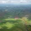
Faint traces of cultivation, following the contour, lie on a moderately steep E-facing slope on Wideopen Hill, above the head of a tributary feeding into the Folly Hope. Barely discernible on the ground, the extent of the cultivation, which covers 120m from NNE to SSW by 50m, is visible on vertical aerial photographs (106G/Scot/UK/121 frames 3141 to 3142: 20 June 1946).
RCAHMS MS/2598 No.4/018.

