
Pricing Change
New pricing for orders of material from this site will come into place shortly. Charges for supply of digital images, digitisation on demand, prints and licensing will be altered.
Hayhope Knowe


Cultivation Terrace(S) (Prehistoric)
Site Name Hayhope Knowe
Classification Cultivation Terrace(S) (Prehistoric)
Canmore ID 59005
Site Number NT81NE 36
NGR NT 85833 17736
NGR Description From NT 8585 1780 to NT 8587 1759
Datum OSGB36 - NGR
Permalink http://canmore.org.uk/site/59005


- Council Scottish Borders, The
- Parish Morebattle
- Former Region Borders
- Former District Roxburgh
- Former County Roxburghshire
NT81NE 36 from 8585 1780 to 8587 1759
(Centred NT 85833 17736) Cultivation Terraces (NR)
OS 6" map, (1962).
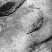
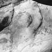
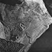
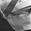
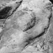
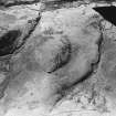
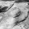
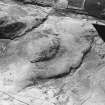
There are cultivation terraces on the NW and S sides of Hayhope Knowe.
RCAHMS 1956, visited 1938.
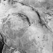
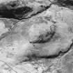
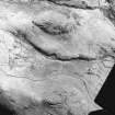
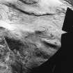
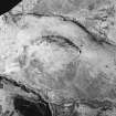
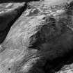
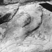
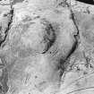
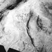
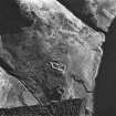
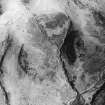
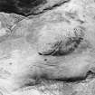
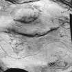
At least ten terraces are evident on the lower W and NW slopes of Hayhope Knowe. They average 0.5m in height while the working areas, on a slight slope, average 6.0m to 10.0m in width. They are not outstanding examples.
Visited by OS (JLD) 26 August 1960 and (RD) 27 June 1968.
Badly eroded, otherwise no change.
Visited by OS (TRG) 9 August 1976.
An area of contour cultivation extends over the steep NW-facing slope and W end of Hayhope Knowe overlooking the Kelsocleuch Burn. The cultivation covers an area measuring 180m from NE to SW by 150m. The limits of the cultivation are undefined except on the N side where it fades out above the Hayhope Sike whilst the possible continuation around the nose of the spur and over the SW-facing slopes (NT81NE 113) must be considered doubtful. About ten terraces may be recognised from vertical aerial photography (RAF 106 G/Scot/UK 121 frame 4352: 20 June 1946), though only five or six could be identified on the ground. The terraces stand up to 0.5m in height and range from 6m to 10m in width. Although the cultivation was previously observed to continue downhill from the complex series of enclosures overlying a scooped settlement (NT81NE 7) (RCAHMS 1956) this relationship could not be established at the date of visit.
Information from RJ Mercer (University of Edinburgh) 16 March 1986
RCAHMS MS 2598. No. 46/601
Sbc Note
Visibility: This is an upstanding earthwork or monument.
Information from Scottish Borders Council

