Pricing Change
New pricing for orders of material from this site will come into place shortly. Charges for supply of digital images, digitisation on demand, prints and licensing will be altered.
Upcoming Maintenance
Please be advised that this website will undergo scheduled maintenance on the following dates:
Thursday, 9 January: 11:00 AM - 3:00 PM
Thursday, 23 January: 11:00 AM - 3:00 PM
Thursday, 30 January: 11:00 AM - 3:00 PM
During these times, some functionality such as image purchasing may be temporarily unavailable. We apologise for any inconvenience this may cause.
Innerwick, Temple Mains Farm
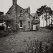
Farmhouse (Period Unassigned), Farmstead (Period Unassigned)
Site Name Innerwick, Temple Mains Farm
Classification Farmhouse (Period Unassigned), Farmstead (Period Unassigned)
Canmore ID 58945
Site Number NT77SW 40
NGR NT 71870 73977
Datum OSGB36 - NGR
Permalink http://canmore.org.uk/site/58945
- Council East Lothian
- Parish Innerwick (East Lothian)
- Former Region Lothian
- Former District East Lothian
- Former County East Lothian
NT77SW 40.00 NT 71870 73977
NT77SW 40.01 NT 71899 73926 Engine House, Mill and Chimney Stack
NT77SW 40.02 NT 71915 73925 Cartshed and Granary
NT77SW 40.03 NT 71924 73946 East Range
Trial Trench (January 2005 - February 2005)
NT 719 739 Archaeological works in January and February 2005 comprised an initial desk-based assessment, a programme of trial trenching, and historic building recording of a Grade B listed farmsteading ahead of its redevelopment as housing.
The desk-based assessment concluded that there was the potential for archaeological remains to survive, although there was later disturbance over areas of the site. Trial trenching, equating to a 5% sample of the development area, revealed a number of features of a relatively modern date. No further archaeological deposits were encountered.
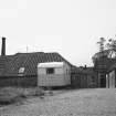
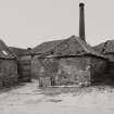
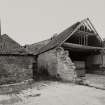
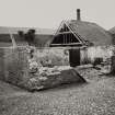
Historic building recording suggested that the standing agricultural buildings can be assigned to three phases, from the late 18th to the late 19th century. They include the remains of a late 18th-century steading, expanded with the addition of a cartshed/granary and, most interestingly, a mid-19th-century threshing mill that probably housed a combined thresher driven by a stationary steam engine.
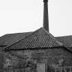
The adjacent engine room and brick stack are well preserved, and bearing boxes are still in situ.
Reports lodged with East Lothian SMR and NMRS.
Sponsor: Swanston Farm Ltd.
G Geddes 2005


