Pricing Change
New pricing for orders of material from this site will come into place shortly. Charges for supply of digital images, digitisation on demand, prints and licensing will be altered.
Upcoming Maintenance
Please be advised that this website will undergo scheduled maintenance on the following dates:
Thursday, 9 January: 11:00 AM - 3:00 PM
Thursday, 23 January: 11:00 AM - 3:00 PM
Thursday, 30 January: 11:00 AM - 3:00 PM
During these times, some functionality such as image purchasing may be temporarily unavailable. We apologise for any inconvenience this may cause.
Dryburn Bridge
Palisaded Enclosure (Prehistoric)
Site Name Dryburn Bridge
Classification Palisaded Enclosure (Prehistoric)
Canmore ID 58816
Site Number NT77NW 30
NGR NT 72515 75630
Datum OSGB36 - NGR
Permalink http://canmore.org.uk/site/58816
- Council East Lothian
- Parish Dunbar
- Former Region Lothian
- Former District East Lothian
- Former County East Lothian
NT77NW 30 NT 72515 75630
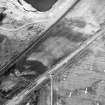
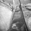
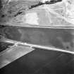
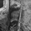
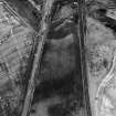
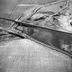
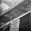
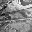
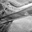
Oblique aerial photography (RCAHMSAP 1980, 1995) has revealed the cropmarks of a circular palisaded enclosure, approximately 150m WNW of Dryburn Bridge. The enclosure measures about 35m to 40m in diameter, with a sub-circular cropmark in the interior to the SE. A linear cropmark intersects it at the SE side.
Information from RCAHMS (KJ) 6 May 1999.
NT 7210 7620 Archaeological trial trenching, amounting to 26,500m2, in the westernmost 50ha portion of a proposed 182ha quarry development at East Barns, near Dunbar, revealed significant archaeological remains in five discrete areas, three of which will require additional investigative work. Fieldwalking and fluxgate gradiometry surveys were simultaneously undertaken in specific areas distributed across the entire quarry landtake. This survey work will inform future trial trenching in the central and eastern parts of the quarry development.
Fluxgate gradiometry survey.
NT 7250 7563 The palisaded enclosure cropmark was examined in detail. Two circular enclosures were identified together with suggestions of internal features and an anomaly that has been interpreted as possibly a burnt structure.
Sponsor: Blue Circle Industries
J Gooder 2001
Archaeological trial trenching in September and October 2005, amounting to 84,535m2, in the westernmost 132ha portion of a proposed quarry development at East Barns, revealed significant archaeological remains in three discrete areas, all of which will require additional investigative work. Given the excavation of a significant Mesolithic house (DES 2003, 56-7) in the immediate area, a programme of test pit survey, incorporating community involvement, was undertaken concurrently with the evaluation trenching. The 296 test pits failed to discover any significant distribution of small finds, although one barbed-andtanged arrowhead was recovered at NT 7149 7666.
Extensive trenching failed to locate archaeological material at the following sites:
NT77NW 41 Late 18th-century windmill.
NT77NW 19 Two small cropmark enclosures (?ring-ditches).
NT77NW 25 ?Ring-ditch.
Only scant evidence - two curvilinear features - was unearthed when trenching in the area (NT 77 2 7 56) of a palisaded enclosure (NT77NW 30) lying adjacent to the Dryburn. While these two features may represent associated remains, no trace of the palisade slot was unearthed.
The site of at least one stone-built roundhouse with a paved floor and apparently two building phases was discovered at NT 7199 7681. Large piles of stone rubble in adjacent trenches probably mask the ground plan of additional roundhouses.
Post-holes and a curvilinear feature distributed over an area of approximately 500m2 probably denote later prehistoric timber-built roundhouses at NT 7285 7577.
Archive to be deposited in NMRS.
Sponsor: Lafarge Cement UK.
J Gooder, Martin Cook 2005


