
Pricing Change
New pricing for orders of material from this site will come into place shortly. Charges for supply of digital images, digitisation on demand, prints and licensing will be altered.
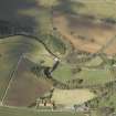
Fogo Parish Church, Churchyard


Burial Ground (Period Unassigned), Churchyard (Period Unassigned), War Memorial (20th Century)
Site Name Fogo Parish Church, Churchyard
Classification Burial Ground (Period Unassigned), Churchyard (Period Unassigned), War Memorial (20th Century)
Alternative Name(s) Parish War Memorial
Canmore ID 96799
Site Number NT74NE 5.01
NGR NT 77251 49169
Datum OSGB36 - NGR
Permalink http://canmore.org.uk/site/96799


- Council Scottish Borders, The
- Parish Fogo
- Former Region Borders
- Former District Berwickshire
- Former County Berwickshire
The oval-shaped graveyard surrounding Fogo Parish Church contains an interesting range of gravestones, dating from the seventeenth to the twentieth century. More recent graves are situated in a southerly extension to the churchyard, which is reached through a lych-gate that also serves as the parish war memorial.
Within the older part of the graveyard former table-top monuments have been wall-mounted. These may have been moved when the church was extended. Gravestones are visible which display classical detailing, and there are also large chest tombs and stones with intricate carving, including one undated sandstone panel which bears three figures, thought to be in late seventeenth or early nineteenth century dress.
Fogo Parish Church is situated near to Charterhall Airfield, which was used during the First and Second World Wars. In the churchyard, there are war graves of members of the forces from Britain, Canada, Australia and New Zealand. There were once three German war graves here as well, but these were removed for reburial in a German Military Cemetery in the 1960s.
Text prepared by RCAHMS as part of the Accessing Scotland's Past project
NT74NE 5.01 77251 49169
There was a church at Fogo by the mid-12th century, although the present building, which stands within a roughly pear-shaped burial ground, is largely of 18th century date.
RCAHMS 1980.
Sbc Note (15 April 2016)
Visibility: Standing structure or monument.
Information from Scottish Borders Council

