Pricing Change
New pricing for orders of material from this site will come into place shortly. Charges for supply of digital images, digitisation on demand, prints and licensing will be altered.
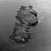
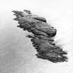
Isle Of May
No Class (Event)
Site Name Isle Of May
Classification No Class (Event)
Alternative Name(s) May Island; Firth Of Forth; Outer Forth Estuary; North Sea
Canmore ID 81629
Site Number NT69NE 9
NGR NT 65 99
NGR Description Centred NT 65 99
Datum OSGB36 - NGR
Permalink http://canmore.org.uk/site/81629
- Council Fife
- Parish Anstruther Wester
- Former Region Fife
- Former District North East Fife
- Former County Fife
NT69NE 9 centred 65 99
Extends onto map sheets NO60SW, and NT69NW.
A comprehensive survey and excavation programme aimed at recording, revealing, consolidating and interpreting a range of sites on the Isle of May was commissioned by Fife Regional Council and Scottish Natural Heritage and executed in April 1992 by John Hunter, Bradford University. This recorded over 100 sites ranging in date from the medieval period to the 2nd World War. Of particular interest were a range of outlying pottery scatters, especially on the tidal North Ness; these are likely to represent hermit's cells.
H James and P Yeoman 1992.


