Pricing Change
New pricing for orders of material from this site will come into place shortly. Charges for supply of digital images, digitisation on demand, prints and licensing will be altered.
Upcoming Maintenance
Please be advised that this website will undergo scheduled maintenance on the following dates:
Thursday, 9 January: 11:00 AM - 3:00 PM
Thursday, 23 January: 11:00 AM - 3:00 PM
Thursday, 30 January: 11:00 AM - 3:00 PM
During these times, some functionality such as image purchasing may be temporarily unavailable. We apologise for any inconvenience this may cause.
Fidra, Castle Tarbet
Castle (Medieval)
Site Name Fidra, Castle Tarbet
Classification Castle (Medieval)
Alternative Name(s) Old Castle Of Eldbottle
Canmore ID 56647
Site Number NT58NW 2
NGR NT 5143 8674
Datum OSGB36 - NGR
Permalink http://canmore.org.uk/site/56647
- Council East Lothian
- Parish Dirleton
- Former Region Lothian
- Former District East Lothian
- Former County East Lothian
NT58NW 2 5143 8674.
(NT 5143 8674) Castle (NR) (site of)
OS 6" map (1971)
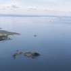
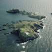
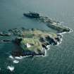
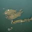
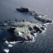
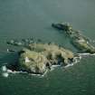
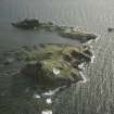
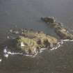
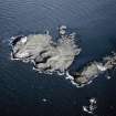
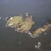
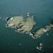
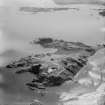
'Castle Tarbet', Fidra. A rocky arm projects towards the SE of the island, from which it is separated at high tide. It terminates in a flat-topped columnar rock, rising some 40ft above high water mark. A rough track leads round the face of this rock and winds up to the summit on the E. Along the one side of this track, as it mounts to the summit, are remains of a mortar-built wall, which has probably formed a parapet. On the summit there are no visible remains of buildings, though there are suggestions of foundations.
A castle was known here in 1220 and 1621 as the 'old castle' of Eldbottle.
RCAHMS 1924, visited 1913
The site of this castle is as described. The summit, 40.0m long by 8.0m wide in the centre, and 16.0m at the E end, has no trace of foundations, except for the mortared stretch 6.0m long.
Visited by OS (JLD) 14 May 1965.
A Castle was known here in 1220 and referred to as the 'old castle' of Eldbotle in 1621. There are reports of fragmentary mortared foundations on the summit of this rock
Site recorded by GUARD during the Coastal Assessment Survey for Historic Scotland, 'The Firth of Forth from Dunbar to the Coast of Fife' 19th February 1996.
Field Visit (4 August 1913)
A rocky arm projects towards the south-east of the island from which it is separated at high tide. It terminates in a flat-topped columnar rock, which rises some 40 feet above the high water level. A rough track leads round the south face of this rock and winds up to the summit on the east. Along the one side of this track, as it mounts to the summit, are remains of a mortar-built wall, which has probably formed a parapet. On the summit there are no visible remains of buildings, though there are suggestions of foundations. Cf. RCAHMS 1924, Introd. p. xli.
RCAHMS 1924, visited 4 August 1913.


