
Pricing Change
New pricing for orders of material from this site will come into place shortly. Charges for supply of digital images, digitisation on demand, prints and licensing will be altered.
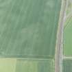
Drem


Cropmark(S) (Period Unknown), Ring Ditch(S) (Period Unassigned)(Possible)
Site Name Drem
Classification Cropmark(S) (Period Unknown), Ring Ditch(S) (Period Unassigned)(Possible)
Canmore ID 130403
Site Number NT57NW 108
NGR NT 50184 79445
Datum OSGB36 - NGR
Permalink http://canmore.org.uk/site/130403


- Council East Lothian
- Parish Athelstaneford
- Former Region Lothian
- Former District East Lothian
- Former County East Lothian
NT57NW 108 NT 50184 79455
A ring-ditch measuring approximately 9m in diameter has been revealed by aerial photography 650m WSW of Drem farmsteading. Indeterminate cropmarks are visible in the surrounding area and cropmarks of four enclosures have been recorded in the S half of the same field (NT57NW 42, NT57NW 97, NT57NW 109, NT57NW 110 ).
Information from RCAHMS (KB) 16 December 1999

