Pricing Change
New pricing for orders of material from this site will come into place shortly. Charges for supply of digital images, digitisation on demand, prints and licensing will be altered.
Upcoming Maintenance
Please be advised that this website will undergo scheduled maintenance on the following dates:
Thursday, 9 January: 11:00 AM - 3:00 PM
Thursday, 23 January: 11:00 AM - 3:00 PM
Thursday, 30 January: 11:00 AM - 3:00 PM
During these times, some functionality such as image purchasing may be temporarily unavailable. We apologise for any inconvenience this may cause.
Blackchester
Fort (Prehistoric), Armlet (Glass)(Middle Iron Age)
Site Name Blackchester
Classification Fort (Prehistoric), Armlet (Glass)(Middle Iron Age)
Alternative Name(s) 'Roman Fort'; Camp Knowes
Canmore ID 55398
Site Number NT52NE 1
NGR NT 5610 2736
Datum OSGB36 - NGR
Permalink http://canmore.org.uk/site/55398
- Council Scottish Borders, The
- Parish Bowden
- Former Region Borders
- Former District Ettrick And Lauderdale
- Former County Roxburghshire
NT52NE 1 5610 2736.
(Centre: NT 5610 2736) Blackchester (Roman Station) (R)
(Supposed Site of).
OS 6" map (1924)
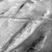
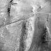
Fort, Blackchester. This fort, which is situated a quarter of a mile ESE of Clarilaw farm, occupies the top of a rocky ridge lying NE and SW at a height of 500ft OD. The SE side of the ridge is steep and some 40ft high, but the other sides are gently inclined and not more than 15ft high.
Although it has been heavily damaged by quarrying and cultivation, the fort is clearly a native work of a type common in western Roxburghshire, and is not of Roman construction, as is suggested on the OS map. Kinghorn's sketch of the remains, referred to by Chalmers, cannot be traced, but according to the latter the shape of the fort was that of a parallelogram with the corners rounded off, and the defences comprised "a double fosse and rampart".
Today the defences have been completely levelled on the NW side, but the inner rampart survives as a low bank at the SW end at right angles to the main axis of the ridge. A gap in the centre of this bank, now used by a farm track, probably represents an original entrance. On the SE side a spine of rock, bordering the top of the ridge, has been dressed to serve as a base for the inner rampart; it measures 12ft to 15ft in thickness at the base, averages 4ft in height, and for a length of 30ft shows a perfectly straight and perpendicular inner face. This method of rampart-construction is frequently found in forts of this type, but no better example has been observed. The NE end of the fort may be represented by either of two wasted banks which cross the neck of the ridge 265ft and 450ft respectively from the SW end. The interior, which has measured about 100ft from NW to SE, is partly under cultivation at the present time and contains no sign of structures.
RCAHMS 1956, visited 1949
Fort: a ramparted or walled structure, clearly sited and constructed primarily for defence, and presumably of IA or DA date.
Information from a letter from K A Steer 13 October 1953
The fort is generally as described above.
Revised at 25".
Visited by OS (EGC) 21 February 1961
Note (19 August 2015 - 10 August 2016)
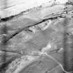
This fort is situated on an irregular rocky ridge that forms the summit of a low hill ESE of Clarilaw. The ground falls away steeply around the flanks of the ridge, particularly on the SE, where a rib of outcrop up to 4.5m thick by 1.2m high serves for the rampart, in the opinion of the RCAHMS investigators in 1949, dressed for the purpose, but elsewhere the defences have been heavily reduced by cultivation and quarrying. As described in 1949, a single rampart was drawn across the SW end of the ridge, while at the NE end two were set likewise some 50m apart, and there was little trace of the inner extending along the NW flank. The first edition of the OS 25-inch map, however, shows no fewer than three ramparts at the SW end, the medial one of which is clearly visible on aerial photographs, despite the gorse growing on the spine of the ridge here. The wide spacing of the ramparts at the NE end suggests there may be two phases of enclosure here, the smaller measuring about 80m from NE to SW by 28m transversely (0.2ha), and the larger rather longer at some 135m in length (0.33ha). Only one entrance is visible and this is at the S end, but others may have been obliterated by cultivation. The interior is featureless.
Information from An Atlas of Hillforts of Great Britain and Ireland – 10 August 2016. Atlas of Hillforts SC3309
Sbc Note
Visibility: This is an upstanding earthwork or monument.
Information from Scottish Borders Council


