Scheduled Maintenance
Please be advised that this website will undergo scheduled maintenance on the following dates: •
Tuesday 3rd December 11:00-15:00
During these times, some services may be temporarily unavailable. We apologise for any inconvenience this may cause.
Lugate Water, Bridge No.70
Railway Bridge (19th Century)
Site Name Lugate Water, Bridge No.70
Classification Railway Bridge (19th Century)
Alternative Name(s) The Waverley Line; Edinburgh To Hawick Branch Railway; Haughead
Canmore ID 283855
Site Number NT44SE 28.09
NGR NT 45267 43144
Datum OSGB36 - NGR
Permalink http://canmore.org.uk/site/283855
- Council Scottish Borders, The
- Parish Stow
- Former Region Borders
- Former District Ettrick And Lauderdale
- Former County Midlothian
NT44SE 28.09 45262 43144
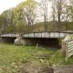
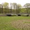
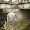
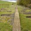
Two span cast iron bridge spanning the Lugate Water 300m SE of the Lugate Bridge (NT44SE 37). Bow shaped girders and a metal hand rails. Angled stone abutments and a central stone pier.
Project (April 2009 - February 2015)
The Borders Railway Project proposals are to reinstate the Newcraighall to Tweedbank section of the former Waverley Line. The reinstated railway line will be approximately 48km long and the majority of the route will use the existing railway embankment.
Several field surveys, archaeological evaluations and standing building surveys were undertaken by CFA Archaeology from April 2009 until February 2015.
CFA Archaeology


