
Inveresk, Crookston Road


Field System (Roman), Unidentified Pottery (Roman)
Site Name Inveresk, Crookston Road
Classification Field System (Roman), Unidentified Pottery (Roman)
Alternative Name(s) Lewisvale Public Park
Canmore ID 53714
Site Number NT37SE 69
NGR NT 35135 71835
Datum OSGB36 - NGR
Permalink http://canmore.org.uk/site/53714


- Council East Lothian
- Parish Inveresk (East Lothian)
- Former Region Lothian
- Former District East Lothian
- Former County Midlothian
NT37SE 69 NT 35135 71835
See also NT37SE 34 and NT37SE 50 NT37SW 21.
Excavation (October 1989 - November 1989)
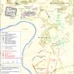
NT 350 718. An excavation was carried out during October/November 1989 by APG in advance of a proposed housing development at Crookston Road, Inveresk, on part of an extensive field system, occupying a ridge to the E and SE of the Roman fort of Inveresk (NT37SW 8), in the S of the scheduled area, between Lewisvale Public Park and Edenhall Hospital. Aerial photographs had shown cropmarks indicative of the boundary ditches of a field system, and the continuation of a triple-ditched feature (NT37SW 21), visible as a cropmark in the adjacent field to the N and investigated by Professor St Joseph in the 1960s.
Geophysical survey preceded excavation of a trench c200m long by 5m wide, SE of and parallel to the edge of the scheduled area, and a 300 square metre area at the NW end of the trench, where it was expected the triple-ditched feature would lie. The overburden was found to be up to 1.5m deep at the NW end of the field; this yielded large quantities of predominantly modern material.
The two outermost ditches of the triple-ditched feature were located in the excavated area. These revealed V-shaped profiles, the "middle" ditch having a relatively well-defined "ankle-break". One sherd of Samian ware (Dr 37) lay on the top of the fill of this ditch. There was no obvious indication of collapsed turf in the fill of the ditches, which seem to have lain open for some time.
The excavation remains were commensurate with the cropmark evidence and seem likely to represent the remains of old boundary ditches. A base sherd of Samian ware (Dr 37) was found in one ditch and 8 sherds of Black Burnished ware (BB 1) and a sherd of Samian were found in one of a group of pits.
Sponsors: HBM, Woodroy Ltd.
A F Leslie 1990.
Unspecified Geophysical Survey Technique (1989)
Geophysical survey was undertaken prior to an archaeological excavation in advance of a housing development at Crookstown Road, Inveresk. The area investigated covered part of the extensive field-system to the S of the Roman Vicus at Inveresk and included the southward continuation of a triple ditch feature (NT37SW 21). The geophysical survey proved to be archaeologically unrewarding.
A Leslie 2002
Aerial Photographic Interpretation
NT 351 718. Field System, Inveresk: visible on aerial photographs.
(Undated) information in NMRS.

