Pricing Change
New pricing for orders of material from this site will come into place shortly. Charges for supply of digital images, digitisation on demand, prints and licensing will be altered.
Smeaton, Brick And Tileworks
Brickworks (19th Century), Tile Works (19th Century)
Site Name Smeaton, Brick And Tileworks
Classification Brickworks (19th Century), Tile Works (19th Century)
Alternative Name(s) Dalkeith Northern Bypass
Canmore ID 53416
Site Number NT36NW 109
NGR NT 348 690
NGR Description NT c. 348 690
Datum OSGB36 - NGR
Permalink http://canmore.org.uk/site/53416
- Council Midlothian
- Parish Dalkeith
- Former Region Lothian
- Former District Midlothian
- Former County Midlothian
NT36NW 109 348 690
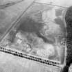
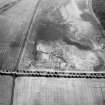
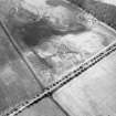
NT 348 690. The site of Smeaton brick and tile works was subject to a documentary study and limited excavations as part of the A68 Dalkeith Northern Bypass. The works, known to have been in operation during the 19th century, are now only visible as cropmark traces on aerial photographic coverage. Documentary study indicated the considerable scale of production achieved by the works in the mid-19th century. Trenching located a series of building foundations with two internal kilns. Kiln 1 was rectangular in shape and survived as a series of fire- boxes with an internal loading chamber or gallery 4.80m wide (its length was not established), within a building measuring 16m by 12m. This building originally comprised a series of several courses of red brick and mortar above a substantial sandstone foundation c0.4m deep. Exterior floors of red brick wee laid to form the stoking floors. Kiln 2, 5.80m wide, was enclosed within a rectangular building measuring 16.10m by 11.80m. The gallery of the kiln had an internal width of 3m with a mortared brick floor and fireboxes on the E and W walls. The stoking floor of this kiln was composed of sandstone flags. In addition, an ancillary coal store was identified; it appears to have been connected by a nearby tramway to the colliery at Smeaton Mains. Two large dumps of waster material were located and sampled to provide information on the range of products.
Sponsor: Roads Directorate of The Scottish Office Industry Department, managed on its behalf by Historic Scotland.
M Cressey 1995.
Site identified during an archaeological assessement carried out by CFA Archaeology Ltd.
Mhairi Hastie, 2006.


