
Pricing Change
New pricing for orders of material from this site will come into place shortly. Charges for supply of digital images, digitisation on demand, prints and licensing will be altered.
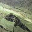
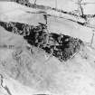
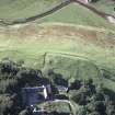
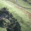
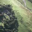
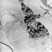
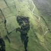
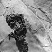
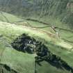
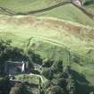
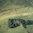
Caerlanrig


Farmhouse (Period Unassigned), Farmstead (Period Unassigned)
Site Name Caerlanrig
Classification Farmhouse (Period Unassigned), Farmstead (Period Unassigned)
Alternative Name(s) Watch Knowe; Carlenrig Farm
Canmore ID 115213
Site Number NT30SE 10
NGR NT 3989 0482
Datum OSGB36 - NGR
Permalink http://canmore.org.uk/site/115213


- Council Scottish Borders, The
- Parish Teviothead
- Former Region Borders
- Former District Roxburgh
- Former County Roxburghshire
Watching Brief (18 February 2021)
NT 3989 0481 Headland Archaeology (UK) Ltd was commissioned by Mr Walter Douglas to undertake a watching brief during ground-breaking works at land south-west of Carlenrig Farm, Teviothead, Scottish Borders. The programme of works was required as part of a condition of planning in advance of the construction of a new dwelling house. The condition was set by the Scottish Borders Council. The watching brief consisted of monitoring the topsoil strip of the footprint of the development. No features of archaeological interest were observed.
Information from Donald Wilson Headland Archaeology.

