Pricing Change
New pricing for orders of material from this site will come into place shortly. Charges for supply of digital images, digitisation on demand, prints and licensing will be altered.
Upcoming Maintenance
Please be advised that this website will undergo scheduled maintenance on the following dates:
Thursday, 9 January: 11:00 AM - 3:00 PM
Thursday, 23 January: 11:00 AM - 3:00 PM
Thursday, 30 January: 11:00 AM - 3:00 PM
During these times, some functionality such as image purchasing may be temporarily unavailable. We apologise for any inconvenience this may cause.
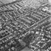
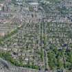
Edinburgh, Grange Cemetery, With Boundary Walls And Railings
Cemetery (19th Century)
Site Name Edinburgh, Grange Cemetery, With Boundary Walls And Railings
Classification Cemetery (19th Century)
Alternative Name(s) Marchmont; Beaufort Road; Edinburgh Southern Cemetery; Lover's Loan; Kilgraston Road
Canmore ID 87701
Site Number NT27SE 591
NGR NT 25689 71909
NGR Description Centred NT 25689 71909
Datum OSGB36 - NGR
Permalink http://canmore.org.uk/site/87701
- Council Edinburgh, City Of
- Parish Edinburgh (Edinburgh, City Of)
- Former Region Lothian
- Former District City Of Edinburgh
- Former County Midlothian
NT27SE 591.00 25689 71909
NT27SE 591.01 25762 72006 Gates and Gate-piers.
NT27SE 591.02 25695 71887 Vaults
NT27SE 591.03 25583 71793 Cemetery Extension
NT27SE 591.04 25575 71827 Cemetery Extension
NT27SE 591.05 25566 71851 Cemetery Extension
INVENTORY OF GRAVEYARD AND CEMETERY SITES IN SCOTLAND REFERENCE:
N.B. This reference applies collectively to NT27SE 591.00, NT27SE 591.03, NT27SE 591.04, NT27SE 591.05
Address: Grange Cemetery, Beaufort Road, Edinburgh
Postcode: EH1 1RF
Status: In current use for burials
Size: Cemetery: 4.10 hectares, 10.12 acres; Cemetery Extension (591.03): 0.28 hectares, 0.70 acres; Cemetery Extension (591.04): 0.19 hectares, 0.47 acres; Cemetery Extension (591.05): 0.15 hectares, 0.37 acres
Polygon: No
TOIDs:
Number of gravestones: Not known
Earliest gravestone: Not known
Most recent gravestone: Not known
Description: Public cemetery opened 1847
Data Sources: OS MasterMap checked 20 September 2005; Bereavement Services Portal checked 20 September 2005
NT27SE 591.00 25689 71909
Designed by David Bryce, and opened 15 May 1847. The first internment was Dr Thomas Chalmers.
Grange Association 1982
NT27SE 591.01 25762 72006 Gates and Gate-piers.
NT27SE 591.02 25695 71887 Vaults
NT27SE 591.03 25583 71793 Cemetery Extension
NT27SE 591.04 25575 71827 Cemetery Extension
NT27SE 591.05 25566 71851 Cemetery Extension


