
Pricing Change
New pricing for orders of material from this site will come into place shortly. Charges for supply of digital images, digitisation on demand, prints and licensing will be altered.
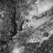
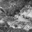
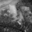
Hawthornden, Well


Well (Post Medieval)
Site Name Hawthornden, Well
Classification Well (Post Medieval)
Canmore ID 51801
Site Number NT26SE 12
NGR NT 2862 6366
Datum OSGB36 - NGR
Permalink http://canmore.org.uk/site/51801


- Council Midlothian
- Parish Lasswade
- Former Region Lothian
- Former District Midlothian
- Former County Midlothian
NT26SE 12 2862 6366.
(NT 2862 6366) Well (NR)
OS 6" map (1957)
This well, over 30' deep and nearly 6' wide, connects with the caves beneath Hawthornden Castle (see NT26SE 16). At the level of the cave roof, the sides of the well have several bar-holes and horizontal slots, evidently for fixing beams to carry a massive wooden lid.
F R Coles 1911
This well, surrounded at the top by an iron railing, is generally as described.
Visited by OS (SFS) 31 October 1975

