
Pricing Change
New pricing for orders of material from this site will come into place shortly. Charges for supply of digital images, digitisation on demand, prints and licensing will be altered.
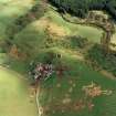
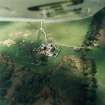
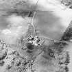
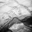
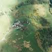
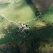
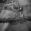
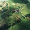
Brunston, Fish Ponds


Fishpond(S) (16th Century)
Site Name Brunston, Fish Ponds
Classification Fishpond(S) (16th Century)
Alternative Name(s) Brunstane; Brunstain; Brunstone
Canmore ID 51647
Site Number NT25NW 4.01
NGR NT 20232 58300
Datum OSGB36 - NGR
Permalink http://canmore.org.uk/site/51647


- Council Midlothian
- Parish Penicuik (Midlothian)
- Former Region Lothian
- Former District Midlothian
- Former County Midlothian
NT25NW 4.01 20232 58300.
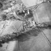
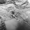
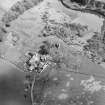
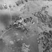
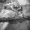
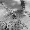
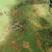
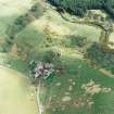
A hundred yards E of the ruin of Brunston Castle is a rectilinear excavation 4' deep, in which rise four flat mounds, c. 53' x 35'. The ditches average 22' in breadth, measured scarp to scarp, and are wet and swampy even in the driest weather. A spring is a few yards W. The S ditch appears to have been bordered by a wall of turf and stone. These remains are very possibly those of a fish pond.
RCAHMS 1929, visited 1920
NT 2023 5850 A fish pond, now dried up, comprising four flat mounds separated and enclosed by flat bottomed ditches 7.0m broad and up to 1.0m high. The mounds range in size from 12.0m by 8.0m to 19.0m by 11.0m.
Surveyed at 1:2500.
Visited by OS (BS) 6 November 1975.
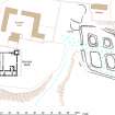
Ground Survey (17 March 2008 - 20 March 2008)
Survey of the fishponds at Brunston Castle

