Pricing Change
New pricing for orders of material from this site will come into place shortly. Charges for supply of digital images, digitisation on demand, prints and licensing will be altered.
Edinburgh, Cramond Island, The Knoll
Coastal Battery (Second World War)
Site Name Edinburgh, Cramond Island, The Knoll
Classification Coastal Battery (Second World War)
Alternative Name(s) 'At The S End Of Cramond Island'; Forth Defences
Canmore ID 106631
Site Number NT17NE 100
NGR NT 19566 78227
Datum OSGB36 - NGR
Permalink http://canmore.org.uk/site/106631
- Council Edinburgh, City Of
- Parish Edinburgh (Edinburgh, City Of)
- Former Region Lothian
- Former District City Of Edinburgh
- Former County Midlothian
NT17NE 100 19549 78253
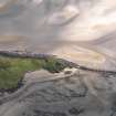
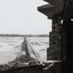
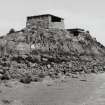
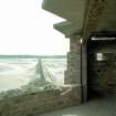
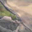
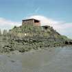
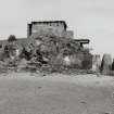
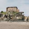
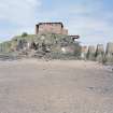
A brick built gun-emplacement is situated at the S end of Cramond Island, on a rock outcrop known as The Knoll overlooking the channel between Cramond and the Island. In the upper storey of the building is a covered concrete platform with small holdfast. This battery overlooks what was an anti-shipping barrier running between Cramond and Cramond Island (NT17NE 118).
Information from RCAHMS (DE) August 1996
A concrete and brick 75mm gun emplacement at the N end of the anti-shipping barrier. Comprising an overhead cover and magazines with one searchlight emplacement, covering the concrete boom.
The battery was installed in 1941 to provide covering fire to the barrier and was intended to have both an anti-ship and anti-tank role.
J A Guy 1997; NMRS MS 810/5, 51,53
Flat roofed brick built structure. Gun battery to protect the anti-shipping barrier (see NT 1935 7780 below).
Site recorded by GUARD during the Coastal Assessment Survey for Historic Scotland, 'The Firth of Forth from Dunbar to the Coast of Fife' 10th March 1996.
There are two separate emplacements, one being the brick built 75mm gun emplacement, the other being the reinforced concrete searchlight emplacement. It is not a two storey structure as stated. They are two separate buildings on different levels.
Information to RCAHMS via e-mail from Mr J Dods (Cramond Heritage Society), April 2006.
Measured Survey (30 August 2022)
HES surveyed the 75mm gun emplacement at Cramond Battery on 30 August 2022 with tape and laser measurer at scale of 1:50. The resultant plan was redrawn in vector graphics software at a scale of 1:100.
Field Visit (2 September 2022)
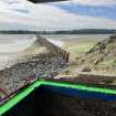
This gun emplacement, which is brick-built upon a concrete raft and with a concrete roof stands on high ground at the S end of Cramond Island, overlooking the anti-boat boom (NT17NE 118) the eastern approach to which it guarded. The emplacement comprises a principal compartment facing SE, which housed a 75mm gun, and two smaller compartments behind separated by a corridor that linked the entrance on the NW side of the building to the main compartment. The gun compartment is rectangular on plan but the centre of the SE side is arced to reflect the rotation of the gun, the position of which is indicated by a holdfast in the floor. The compartment measures 7.34m from NE to SW by a maximum of 5.31m transversely and the walls, which are of varying thickness, stand 2.33m high to a roof that is supported on a framework of rusting vertical and horizontal steel beams.
Both the NE and SW sides contain two embrasures with internal splays.
Of the two compartments to the rear, that on the SW is the smaller and the presence of a hatch in the wall between it and the gun compartment probably indicates that it was a magazine. Internally it measures 2.7m from NW to SE by 2.6m. The other compartment was probably a crew shelter or ready room as it is larger and has a window in its NW side protected externally by a baffle wall and an embrasure with an internal splay in the NE side. The room measures 2.85m from NE to SW by 2.6m. The entrance on the NW side of the building is also protected by a baffle wall and is approached from the SW by way of a flight of concrete steps.
Situated immediately E of and below the level of the gun emplacement is a searchlight emplacement that is reached via a set of concrete steps to its doorway (1.69m wide) at the NW end of its NE side. Of reinforced concrete construction, the emplacement is rectangular on plan, measuring 4.95m from NW to SE by 2.64m transversely and its walls (0.22m thick) rise to a flat roof (0.23m thick) at a height of 2.59m. The wrap-around opening for the searchlight takes in the whole of the SE end of the building and some of both the NE and SW sides. Graffiti is evident on the internal and external walls of both emplacements.
Visited by HES Archaeological Survey (J. Sherriff, A. McCaig) 2 September 2022.
Project
Recording Scotland's graffiti project was designed to review the range of historic and contemporary graffiti art across Scotland. It involved desk-based assessment and fieldwork at a number of example sites, to consider recording methodologies and dissemination practices.
Between 2016 and 2017, phase 1 of the project aimed to:
Aim 1: review a range of historic and contemporary graffiti art from across Scotland, already present in Canmore.
Aim2: undertake a research review of previous approaches to recording graffiti art in Canmore and other HERs, review and develop the current Thesaurus terms.
Aim 3: test and develop a range of recording methods within the following programmes or projects: Discovering the Clyde programme (1223), Scotland’s Urban Past (1222), Architecture and Industry projects, such as Urban Recording Projects (1028), Area Photographic Survey (311) and the Tomintoul and Glenlivet Landscape Partnership (1167).
Aim 4: the following test sites will be considered for research into the range of historic and contemporary graffiti. They will be analysed to demonstrate the different ages, contexts, styles and survivals of historic and contemporary graffiti: Polphail village (Canmore ID 299112), Scalan farmstead (170726), Cowcaddens Subway Station (243099), Croick Parish Church (12503), Dalbeattie Armament Depot (76279) and Dumbarton Rock (43376).
Aim 5: to research the potential for social media to play a role in crowd-sourcing information and archiving Scotland’s graffiti art.
In 2017-2019, phase 2 of the project aimed to:
Aim 1: To enhance the NRHE to the point at which it can be said to adequately represent the broad range of historic and modern graffiti that is evident throughout Scotland, and to explore ways by which that information can best be disseminated.
Aim 2: To develop guidelines that will convey the HES approach to researching and recording graffiti.
Aim 3: To write a specification for a book on Scotland’s graffiti.
Aim 4: To develop external partnerships to explore further ways to record graffiti and to identify and explore potential funding streams to enable further knowledge exchange and research.
The project was managed by Dr Alex Hale, with contributions from staff across Herirtage and Commercial and Tourism directorates.


