
Pricing Change
New pricing for orders of material from this site will come into place shortly. Charges for supply of digital images, digitisation on demand, prints and licensing will be altered.
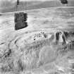
Drumelzier


Cultivation Terrace(S) (Period Unassigned)
Site Name Drumelzier
Classification Cultivation Terrace(S) (Period Unassigned)
Canmore ID 49934
Site Number NT13SW 41
NGR NT 1407 3453
Datum OSGB36 - NGR
Permalink http://canmore.org.uk/site/49934


- Council Scottish Borders, The
- Parish Drumelzier
- Former Region Borders
- Former District Tweeddale
- Former County Peebles-shire
NT13SW 41 1407 3453.
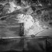
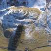
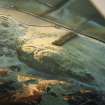
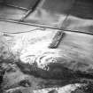
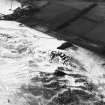
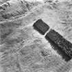
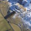
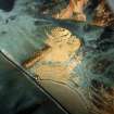
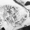
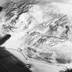
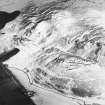
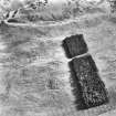
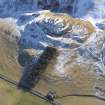
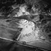
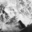
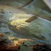
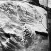
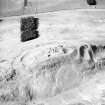
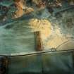
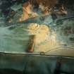
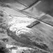
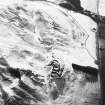
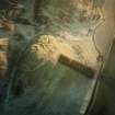
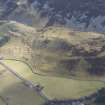
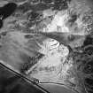
(NT 140 345) There are cultivation terraces on the NW slope of the hill below Tinnis Castle.
RCAHMS 1967, visited 1962.
A group of five insignificant terraces up to 2m high and approximately 4m wide.
Visited by OS(IA) 14 August 1972.
The cultivation terraces are visible on aerial photographs (OS 71/395/015 and 031, flown 1971).
Information from RCAHMS (RJCM) April 1995
Sbc Note
Visibility: This is an upstanding earthwork or monument.
Information from Scottish Borders Council

