The Pineapple, Walled Garden
Pond (Period Unassigned), Summerhouse (Period Unassigned), Walled Garden (Post Medieval)
Site Name The Pineapple, Walled Garden
Classification Pond (Period Unassigned), Summerhouse (Period Unassigned), Walled Garden (Post Medieval)
Alternative Name(s) Dunmore Park
Canmore ID 46851
Site Number NS88NE 40
NGR NS 88893 88520
Datum OSGB36 - NGR
Permalink http://canmore.org.uk/site/46851
- Council Falkirk
- Parish Airth
- Former Region Central
- Former District Falkirk
- Former County Stirlingshire
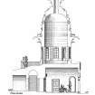
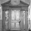
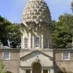
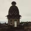
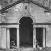
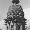
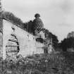
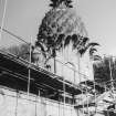
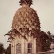
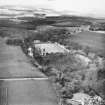
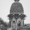
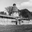
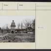
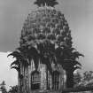
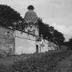
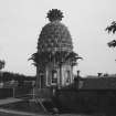
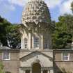
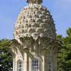
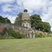
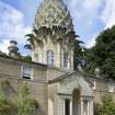
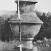
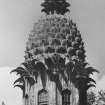
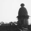
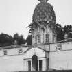
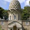
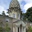
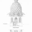
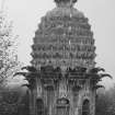
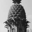
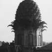
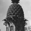
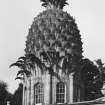
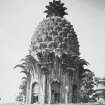
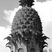
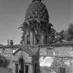
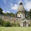
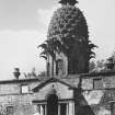
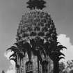
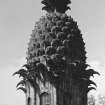
In 1761, a garden pavilion was constructed in the grounds of Dunmore Park. Ten years later, on his return to Scotland from duties as the Governor of Virginia, the Earl of Dunmore commissioned the addition of a huge, 8m high, domed roof in the shape of a pineapple. The property has been converted into holiday accommodation and the surrounding gardens are in the care of the National Trust for Scotland.
Information from RCAHMS (SC) 31 July 2007
Gifford, J and Walker, F A 2002
NS88NE 40 88893 88537
NS88NE 4 89018 88922 Elphinstone Tower
NS88NE 24.00 88490 89195 Dunmore Park
NS88NE 66 88993 88906 St Andrew's Episcopal Church and Churchyard (Dunmore Chapel)
NS88NE 67 89244 88559 The Parsonage
Built 1761, architect unknown.
RCAHMS 1963, visited 1960.
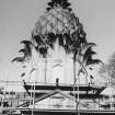
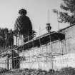
Built for the Earl of Dunmore. Restored and converted to holiday house by Stewart Tod & Partners 1972-9. Saltire Society Award 1980.
SDA & RIAS 1985.
Photographic Survey (1955)
Photographic survey by the Scottish National Buildings Record in 1955.
Field Visit (1 May 1959 - 31 May 1959)
Photographic Survey (May 1959)
Photographic survey by the Scottish National Buildings Record in May 1959.
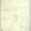
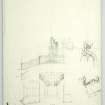
Measured Survey (1960)
Field Visit (1 April 1961 - 30 April 1961)
Publication Account (1985)
The Dunmore Pineapple, which must rank as the most bizarre building in Scotland, has recently been saved from dereliction and is now available to let as holiday accommodation.
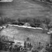
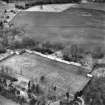
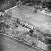
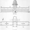
Originally, the Pineapple formed the focal point of the walled garden at Dunmore Park and was the centrepiece of a range of buildings that overlooked the gardens. Built in 1761 by an unknown architect, it was designed as a garden retreat and was flanked by stores and hothouses, in which pineapples may well have been grown. Its eccentric shape reflects the 18th century interest in extravagant garden design and the craze for growing exotic flowers and fruit which required to be raised under artificial conditions.
Information from ‘Exploring Scotland’s Heritage: The Clyde Estuary and Central Region’, (1985).
Field Visit (1987)
Inventory of Gardens and Designed Landscapes in Scotland
Standing Building Recording (6 August 2007 - 7 August 2007)
NS 88930 88500 A section of walling in the main SW Walled Garden at the entrance to the private residence was recorded on 6–7 August 2007, in advance of its reconstruction. A further section of dangerous walling above the cart entrance in the NE Walled Garden was also recorded before remedial work. Distinct phases of development were noted, from the original construction to later repair and consolidation work. Constructional details will be used to enable accurate reconstruction.
Archive: NTS and CHC
Funder: The National Trust for Scotland
David Connolly (Connolly Heritage Consultancy), 2008
Condition Survey (3 November 2012 - 5 November 2012)
An archaeological watching brief was carried out during the dredging of the garden pond at the Pineapple. Dredging uncovered an inlet and revetment wall at the east end of the pond made up of square rusticated sandstone blocks standing to four courses. This design element of the pond had been previously unknown and was covered by up to 0.5m of topsoil on the bank and up to 2m of sediment within the pond itself.
It may be possible that a bridge once crossed the pond at its narrowest point, as suggested by a deposit of broken brick and a single rusticated brick. However, further excavation along the bank would be necessary to try and unearth any foundation for such a structure.
During the dredging a curling stone was recovered from the foot of the eastern revetment wall, giving a good indication of the ponds use within the wider Dunmore Estate.
Reference (February 2013 - February 2013)
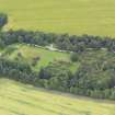
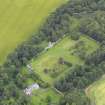
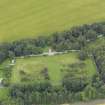
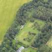
The gardens at the Pineapple, which were once part of the estate of Dunmore Park, consist of woodland, ponds and two walled gardens and cover an area of 6.5ha. A lack of documentary evidence for the original layout of the gardens means that the current gardens are loosely based upon the late 19th century layout.
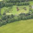
The walled gardens, are actually a larger sub-divided walled garden. The larger western section was subdivided into ten compartments possibly partly by hedges, and in the southern compartment is an ornamental pond, now heavily silted up. The eastern section of the garden was shown in the 1863 map as an orchard; it is divided into two compartments, the southern end is now planted with trees.
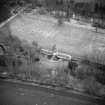
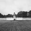
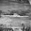
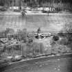
Photographs from 1917 show that there was a path running east-west across the west Walled Garden flanked on each side by herbaceous planting. The Pineapple lay at the top of a wide lawn which was bordered by fruit trees, with glasshouses running along the north wall.
The walls of the garden are brick with freestone dressings; the north one having a double construction with honeycomb cavities through which hot air was circulated for the benefit of fruit trees. Behind the walls were furnaces every few yards, with those nearest to the Pineapple having their chimneys disguised as urns.
(Information from NTS, February 2013)
Information from NTS
Excavation (17 September 2017 - 18 December 2017)
NS 88850 88522 – The Pineapple (walled garden) and NS 88820 88488 – The Pineapple (glasshouse) As part of this project (a cross-sector skills and training initiative) a programme of archaeological work was undertaken, 17 September – 18 December 2017, within the category A listed mid- to late 18th-century walled garden, and the glasshouse and folly, built by the 4th Earl of Dunmore and located within the Dunmore Estate.
The work consisted of a two-day evaluation excavation, a small photographic survey and basic level historic building recording of the interior NW portion of the walled garden. The excavation aimed to explore any surviving remains of a former glasshouse located in the interior of the walled garden and the garden ground makeup forming the interior garden ground. The main objectives were to understand the construction and use of the glasshouse and the surrounding garden ground, to interpret and communicate their story, and to provide a basis for the glasshouse reconstruction.
The historic building recording aimed to provide a training opportunity for participants and to make an initial appraisal of the extant remains of the walled garden to inform the approach for future historic building recording.
Students from the Forth Valley College studying construction, and archaeology students took part in the excavation, receiving training in archaeological fieldwork skills. A desk-based assessment of The Pineapple utilised information available from databases, and has examined
cartographic material. The assessment revealed the changing layout of the folly and glasshouses, and the internal walled garden layout and associated structures. The glasshouse appears to be a mid- to late 19th-century structure, still standing (if not in use) until c1960. A trench was excavated across the footprint of the glasshouse, and two small test pits were dug within the walled garden grounds. Features identified within the glasshouse trench included the remains of internal walling, surfacing / flooring, and a possible heating duct trench; the test pits in the garden ground revealed at least two likely phases of garden ground formation, together with a garden land drain.
The historic building recording and photographic survey revealed evidence for three phases of construction and/or alteration within the NW part of the walled garden wall. The results of the work have been used to provide a series of recommendations for future work as part of the Canal College 2 programme.
Archive and report: NRHE (intended)
Funder: Historic Environment Scotland (HES), Society of Antiquaries of Scotland, and Construction Scotland Innovation Centre
Ian Hill, Phil Richardson, Rebecca Barclay and Doug Rocks-Macqueen – Heritage and Archaeological Research Practice Ltd and Archaeology Scotland
(Source: DES, Volume 18)
Excavation (14 May 2018 - 25 September 2018)
NS 88893 88520 Based upon a previous phase of excavation and building survey work undertaken at the Pineapple Walled Garden as part of the Building Histories Project, two further seasons of archaeological excavation and building recording were undertaken, 14 May – 25 September 2018, at the site (Seasons 1 and 2). This work was undertaken as part of Scottish Waterways Trust Canal College Scheme, a training and youth employability scheme supported by Archaeology Scotland.
The work aimed to explore any surviving remains of a former small mid-late 19th-century glasshouse located on the NW interior of the walled garden, and the History of use of the walled garden and other structures formerly present within it. The main objectives were to understand the construction and use of the glasshouse and the surrounding garden, to interpret and communicate their story, and to provide a basis for the overall future management of the site by the NTS.
A photographic survey and basic building recording were undertaken of elements of the interior elevations of the walled garden, primarily located in the NW corner of the garden at the locations of former glasshouses shown on OS maps. This work has recorded several features present on the interior garden walls, including former roof lines, blocked up doorways, glasshouse heat management systems, possible glass house roof and other interior fixings such as metal loops and hooks for anchoring ropes and plants. The building survey work will contribute to future recording and conservation management of the walled garden.
During the Building Histories Project, a small trial trench was excavated across the location of the small glasshouse. This identified the remains of internal walling, surfacing/flooring, possible bedding areas and a possible heating duct trench. During the Canal College Scheme, the trench was re-opened in Season 1, and the features previously identified were investigated. Season 2 saw the trench extended and then further excavated. Overall, the trench measured 4.4m N/S by 3.5m E/W, and was excavated to a maximum depth of 0.7m in the NW corner of the trench where a small sondage was excavated into the basal deposits present in the trench.
Excavation during Seasons 1 and 2 recorded several deposits of brick rubble, mixed soil, blaize and ash dumps, which appear to have been used to infill and level the majority of the glasshouse interior prior to the construction of the areas of paving and surfacing, a brick pathway bisecting the glasshouse, and a low slate-capped secondary interior brick wall aligned with the main sandstone outer wall foundations. This later feature was previously thought to form a heating duct trench, but as yet no evidence has been identified to support this interpretation. Underlying the various deposits of rubble and soil infill in the northern half of the trench, a deposit of yellow crushed sandstone and sandstone rubble was recorded, which appears to overlie further mixed soil deposits and an alignment of rough sandstone stones, which have been interpreted as representing either an earlier structure and phase of use of the glasshouse, or, alternatively wall foundation stones for the main walled garden wall which formed the northern side of the small glasshouse.
Archive: NRHE and NTS (landowner)
Funder: Scottish Waterways Trust
Héléna Gray – Archaeology Scotland and Scottish Waterways Trust
(Source: DES Vol 19)
Excavation (February 2019 - October 2019)
NS 88893 88520 Based upon previous programmes of excavation and building survey work undertaken at the Pineapple Walled Garden (Canmore ID: 46851) as part of the Canal College 2 Scheme (DES 2018, 91-2), a further three programmes of work were undertaken in 2019 during February, May/ June, and September/October.
The project is part of the Keep Scotland Beautiful (formerly Scottish Waterways Trust) Canal College Scheme, a training and youth employability scheme supported by Archaeology Scotland.
The work aimed to explore the surviving remains of a small mid-late 19th-century glasshouse located on the NW interior of the walled garden, and the history of use of the walled garden and other structures formerly present within it. The main objectives being to understand the construction and use of the 19th-century structure and the surrounding garden; to interpret and communicate their story; and to provide a basis for the overall future management of the site by the National Trust for Scotland.
Previous work included photographic survey and basic building recording, on elements of the interior elevations of the walled garden. The building recording work continued to focus on the southern elevation of the walled garden in the NW corner, which originally formed the northern wall of the former 19th-century glasshouse. A number of features had been identified on this south-facing elevation, such as interior fixings like metal loops and hooks, and evidence for possible heat management systems, and the 2019 survey continued to record the identified features in detail. The survey also identified a number of features on the east-facing elevation of the walled garden in the NW corner, which formed the western wall of the former 19th century glasshouse.
Previous phases of investigation involved the excavation of a trench across the central part of the interior of former 19th century glasshouse the trench being gradually extended and excavated during the course of the archaeological work.
The 2019 work further investigated the interior brick channel, the yellow crushed sandstone deposit and underlying clay deposits and stone alignment, and the L-shaped brick structure, extending the trench to approximately 4 x 6m in total, covering the whole of the eastern half of the building interior. The results suggest that the latter feature was a more recent insertion, cutting through the majority, if not all, of the interior infilling deposits, and likely also part of the brick channel walling. The L-shaped structure was filled with more modern rubble and rubbish, extending to at least the depth of the basal clay deposit already identified in the trench; it is possible this feature is the remains of a modern drainage system for a toilet. Excavation also revealed that the stone alignment was a wall, extending along the full length of the northern side of the trench and keyed in to the outer foundation wall visible on the ground surface. This wall had also been cut through by the later L-shaped structure. Excavation within the brick-lined channel revealed several small brick blocking sections of wall placed at intervals along its length. It is unclear if these are contemporary with the channel, or later insertions; they may represent supports for a heating pipe, or re-use of the channel to provide planting areas for plants such as vines. At least one of these small brick features is later, as it is mortared onto a large slab placed in the channel, on the same alignment as the L-shaped structure, suggesting it is associated feature (possible capping for a later drainage system).
Recording of the surface of the capping wall course of the exterior wall foundation was also undertaken. After careful cleaning, each capping stone was photographed, drawn and described. The work recorded several features present on the surface of many of the stones, such as masons’ markings, writing, and lead surrounded square sockets. At present, it is unclear if these form distinct patterns relating to evidence for structural elements relating to glasshouse architecture (e.g. uprights for glass panels) but it seems likely that many of these stones have been reclaimed and re-used from elsewhere.
Archive: NRHE (intended)
Funder: Archaeology Scotland, Scottish Waterways Trust, Keep Scotland Beautiful
Héléna Gray – Archaeology Scotland
(Source: DES Vol 20)


