
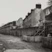
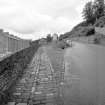
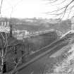
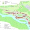
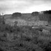
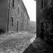
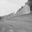
New Lanark, 1-3 Mantilla Row


Tenement (18th Century)
Site Name New Lanark, 1-3 Mantilla Row
Classification Tenement (18th Century)
Alternative Name(s) 128-138 New Lanark Road; New Lanark Mills; New Lanark Industrial Village
Canmore ID 122898
Site Number NS84SE 58.20
NGR NS 87965 42656
Datum OSGB36 - NGR
Permalink http://canmore.org.uk/site/122898


- Council South Lanarkshire
- Parish Lanark
- Former Region Strathclyde
- Former District Clydesdale
- Former County Lanarkshire
NS84SE 58.20 87965 42656

