Scheduled Maintenance
Please be advised that this website will undergo scheduled maintenance on the following dates: •
Tuesday 3rd December 11:00-15:00
During these times, some services may be temporarily unavailable. We apologise for any inconvenience this may cause.
Glasgow, Cowlairs Incline
Railway (19th Century)
Site Name Glasgow, Cowlairs Incline
Classification Railway (19th Century)
Alternative Name(s) Glasgow, Queen Street Station, Approach Incline And Tunnel; Cowlairs Railway Incline
Canmore ID 167770
Site Number NS56NE 1866
NGR NS 59276 65773
NGR Description NS c. 59276 65773 to NS c. 6009 6774.
Datum OSGB36 - NGR
Permalink http://canmore.org.uk/site/167770
- Council Glasgow, City Of
- Parish Glasgow (City Of Glasgow)
- Former Region Strathclyde
- Former District City Of Glasgow
- Former County Lanarkshire
NS56NE 1866.00 c. 59276 65773 to c. 6009 6774
Extends into map sheet NS66NW.
Location formerly cited as NS 5978 6700 and as NS 5922 6566 to NS 5994 6738
NS56NE 1866.01 NS c. 5998 6821 Signal Box
NS56NE 1866.02 NS 5927 6577 to NS 5963 6662 Railway Tunnel (Tunnel portion)
NS56NE 1866.03 NS 59434 66148 Air Shaft (Tunnel portion, under Calgary Street)
NS56NE 1866.04 NS 59324 65884 Air Shaft (Tunnel portion, under Cowcaddens Road)
For stationary engine-house at head of the incline (NS 6009 6774), see NS66NW 460.
For associated and adjacent (to SW) Queen Street (High Level) Station, see NS56NE 76.00.
For Cowlairs (Junction) Station (at head of this incline), see NS66NW 217.
Cowlairs Incline [NAT] (at NS 6005 6761)
OS 1:1250 map, 1952.
Cowlairs Incline [NAT] (at NS 6000 6749)
OS 1:1250 map, 1972.
Cowlairs Incline [NAT] (at NS 5988 6726)
OS 1:1250 map, 1970.
Cowlairs Incline [NAT] (at NS 5971 6680)
OS 1:1250 map, 1973.
NMRS REFERENCE
Glasgow, Cowlairs Incline.
Incline depicted on the revised 2nd edition of the OS 25-inch map (Lanarkshire 1913, sheet VI.7)
Cowlairs cable-hauled incline opened 21.02.1842, cable working ceased 31.10.1908.
(Undated) information in NMRS.
Cowlairs incline was built by the Edinburgh and Glasgow Rly (later incorporated into the North British Rly), and opened on 18 February 1842. The engineer responsible for the incline was John Miller, and trains were formerly rope-hauled under power from a stationary steam engine. On 10 November 1840 the directors of the Edinburgh and Glasgow Rly announced that a contract for the construction of the stationary winding engine had been given to Kerr, Neilson and Co of Glasgow, at a cost of £2900. By May 1841, an order was placed with Heggie and Son of Newcastle for a hemp rope weighing 239cwt (12.1t) and costing £538.32. Trains descended the incline under the control of special brake vehicles, which were attached at the front in place of the locomotive. Ascending trains were assisted by power passed through a haulage rope attached indirectly to the buffer-beam of the leading locomotive. The use of a messenger rope allowed the rope to be detached without stopping, while brake vehicles were returned to the top of the incline attached to the rear of the ascending train, and detached by slipping.
Rope-haulage remained the practice until 1908 despite occasional incidents and repeated attempts to introduce locomotives with sufficient power to allow its abolition. The introduction of electric traction was also considered. Wire ropes were fitted from 1848, allowing a useful increase in the permissible weight of trains but not preventing the occasional mishaps. A second cylinder was added to the haulage engine in the 1850's, allowing an increase in capacity.
In 1906, the following were recorded:
Circumference of cable: 5ins [127mm]
Speed of movement: c. 14mph [21kph]
Life of cable: about 14 months
HP of haulage engine: c. 650
Average weight of trains (excluding engine and tender): c. 200
Nimber of trains per day: 70 to 80.
Following a near-serious accident in January 1902, it was decided to replace rope-haulage with the banking by heavy tank banking engines specially designed for the puropse. These were thoroughly tested before being put in service on 12 December 1907. Rope haulage was abolished on 31 January 1908, authority being given to remove the cable on 26 August 1909.
The track in the tunnel was relaid on concrete ladder units since October 1976, allowing headroom for electrification.
[Details of wire haulage ropes 1848-1902 cited, and comparison made with English inclines].
C Johnston and J R Hume 1979.
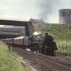
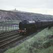
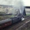
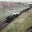
Cowlairs incline forms the steep but straight approach from the NNE into Queen Street High Level station (NS56NE 76.00). It remains in use by regular passenger traffic and measures 2090yds (1911m) in length, the lower portion (NS56NE 1866.02) being in tunnel. The gradient varies between 1-in-41.5 and 1-in-50.
The available map evidence indicates that the incline extends from NS c. 59276 65773 to NS c. 6009 6774.
Information from RCAHMS (RJCM), 7 February 2006.
Modification (1908)
Steam engine orignally installed 1842 to haul locomotives and trains up the 1:44 incline by rope was scrapped. Similar to Liverpool and Manchester Railway. Banking engines were installed in 1908.
Project (2007)
This project was undertaken to input site information listed in 'Civil engineering heritage: Scotland - Lowlands and Borders' by R Paxton and J Shipway, 2007.
Publication Account (2007)
The entry to Queen Street High Level Station for railway traffic is through a tunnel 1040 yards long on an inclined plane of about twice that length with an ascending gradient of 1 in 44 to Cowlairs Station, where a steam-operated winding engine originally existed until 1968 although the machinery was scrapped in 1909. The tunnel, built by Marshall & Co., consisted of three parts, Bell’s Park 272 yards, Asylum 292 yards and Broomhill 476 yards.
These works were constructed in 1840–42 by the Edinburgh & Glasgow under the direction of Miller, at the
end of a line he had engineered almost level. The incline was too steep to be worked by the locomotives of the day and each train had to be assisted by rope haulage and controlled by a special brake wagon when descending. By the end of 1841 the tunnel was white-washed and gas lit and, on Miller’s authorisation, was opened to the public on New Year’s Day 1842 for the benefit of the Paisley Relief Fund and workmen injured on the railway.
The rope haulage system, similar to that on the earlier Liverpool & Manchester, was in the form of an endless
cable operated by a winding engine in a special building at the top of the incline. Trains were connected to the rope as they left Queen Street Station and cast off the connection at the top. This inconvenient method of
working lasted from 1842 to 1908, when banking engines took over.
As a train began to leave the station there was a momentary pause for the rope to be attached. This allowed many a late arriving passenger a few moments more to catch the train!
R Paxton and J Shipway 2007
Reproduced from 'Civil Engineering heritage: Scotland - Lowlands and Borders' with kind permission of Thomas Telford Publishers.


