Following the launch of trove.scot in February 2025 we are now planning the retiral of some of our webservices. Canmore will be switched off on 24th June 2025. Information about the closure can be found on the HES website: Retiral of HES web services | Historic Environment Scotland
Renfrew, Inchinnan Road, White Cart Bridge
Road Bridge (Period Unassigned)
Site Name Renfrew, Inchinnan Road, White Cart Bridge
Classification Road Bridge (Period Unassigned)
Canmore ID 86373
Site Number NS46NE 41
NGR NS 49301 67851
Datum OSGB36 - NGR
Permalink http://canmore.org.uk/site/86373
- Council Renfrewshire
- Parish Renfrew (Renfrew)
- Former Region Strathclyde
- Former District Renfrew
- Former County Renfrewshire
NS46NE 41 49301 67851.
(NS 4930 6784) White Cart Bridge (NAT)
OS 1:10 000 map (1974)
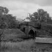
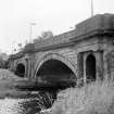
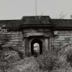
This bridge was built following the destruction of an earlier bridge (1722) in 1809. It was built at the same time as Inchinnan Bridge [NS46NE 19], both bridges being completed in 1812. The bridges are similar in design, with segmental arches framed by attached fluted Greco-Roman Doric columns; built of bull-faced masonry with ashlar parapets.
J A Dunn 1971; SDD Lists 1963.
Archaeological Evaluation (2 October 2018 - 20 February 2019)
NS 48862 67249 (centred) An evaluation was carried out at Abbotsinch road and a historic building recording (HBR) was completed on the southern elevation of White Cart Bridge (LB40425). The work took place on 2 October 2018 to 20 February 2019.
The evaluation revealed one archaeological feature and the remains of relict field boundaries depicted on the 1st Edition OS map of 1864.
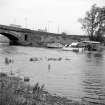
The construction of White Cart Bridge was completed in 1812. It was built as one of a pair of bridges constructed to replace an earlier bridge which collapsed in 1809. The bridge currently spans the silted-up course of the old White Cart River, which was realigned in the late eighteenth century and now runs directly to the east.
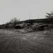
The abutments on either side of the bridge are of a later date and are most likely contemporary with the construction of the adjacent rolling lift bridge in the early twentieth century. Weathering is apparent across the bridge, with some chipping of the archways visible. The belt course has become partially dislodged in places by root growth, especially above passageway G3, while the upper parapet has been repaired in places.
Overall, White Cart Bridge is still in good condition. The majority of the plant growth has been removed, and if this is fully removed and kept under control, then it likely that its good condition will continue.
Archive: NRHE (intended)
Funder: Renfrewshire Council
Kenneth Green; Dave McNicol and Nieves Ruiz-Nieto ̶ GUARD Archaeology Limited
(Source: DES Vol 20)


