Pricing Change
New pricing for orders of material from this site will come into place shortly. Charges for supply of digital images, digitisation on demand, prints and licensing will be altered.
Cardross, Murrays
Fish Trap(S) (19th Century) - (20th Century), Jetty (19th Century)
Site Name Cardross, Murrays
Classification Fish Trap(S) (19th Century) - (20th Century), Jetty (19th Century)
Alternative Name(s) Seabank
Canmore ID 291860
Site Number NS37NW 55
NGR NS 33703 77064
NGR Description NS 33703 77064 and NS 32908 77443
Datum OSGB36 - NGR
Permalink http://canmore.org.uk/site/291860
- Council Argyll And Bute
- Parish Cardross (Argyll And Bute)
- Former Region Strathclyde
- Former District Dumbarton
- Former County Dunbartonshire
NS37NW 55 33703 77064 and 32908 77443
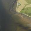
A series of stone rubble fish traps have been identified from oblique aerial photographs taken in September 2007 (RCAHMS 2007), in the inter-tidal area offshore from Murrays farmstead (NS37NW 53) and the anti-aircraft battery (NS37NW 19).
Extending in two separate lines, first in a L-shape from NS 33056 77668 to NS 33081 77279, second, from NS 33467 77139 to NS 33692 77065 to join in a T-junction with a line forming another L-shape from NS 33696 77111 to NS 33899 76995.
The fish traps are depicted on the current OS digital maps at both 1:25000 and 1:2500 scales and are also visible on RAF WW II oblique aerial photographs (F309, 3655 and unnumbered, flown 6 June 1941).
Information from RCAHMS (DE), December 2007
Aerial Photographic Interpretation (December 2007)
A series of stone rubble fish traps have been identified from oblique aerial photographs taken in September 2007 (RCAHMS 2007), in the inter-tidal area offshore from Murrays farmstead (NS37NW 53) and the anti-aircraft battery (NS37NW 19).
Extending in two separate lines, first in a L-shape from NS 33056 77668 to NS 33081 77279, second, from NS 33467 77139 to NS 33692 77065 to join in a T-junction with a line forming another L-shape from NS 33696 77111 to NS 33899 76995.
The fish traps are depicted on the current OS digital maps at both 1:25000 and 1:2500 scales and are also visible on RAF WW II oblique aerial photographs (F309, 3655 and unnumbered, flown 6 June 1941).
Information from RCAHMS (DE), December 2007
Project (September 2014 - 2015)
This project, which was largely undertaken in 2015 and 2016, initially comprised a desk-based qualitative assessment of about 360 Canmore records for which a direct association with the River Clyde could be demonstrated, identifying which records could be enhanced, and how, in a subsequent project. The desk-based phase of the project was followed by a programme of fieldwork (https://canmore.org.uk/project/1024867) which identified over 300 previously unrecorded sites along the river.
Field Visit (21 May 2015)
This site comprises a jetty that has later been converted into a fish trap. The earlier jetty is depicted on the Admiralty Chart of Scotland, River Clyde From Greenock to Dumbarton sheet, published in 1850. It depicts a jetty that runs perpendicular to the shoreline with a short extension to the east, at the south end. There is a ‘Pole’ depicted at the south end of the jetty. The jetty is annotated ‘Geilstone Ferry’ on this Admiralty Chart. The jetty comprises a low pile of rough stones that measures 130m from NNW to SSE and up to 16m in breadth.
The jetty has been later re-used as part of a fish trap. A linear extension of rough stone runs from the south end of the jetty for over 100m to the east, which runs parallel with the shore. The fish trap extension is depicted on the 3rd Edition of the OS 25 inch map (Dumbarton n017.16, 1918), as is another extension to the west of the pier, and extends for over 250m.
Visited by RCAHMS (AGCH) 21 May 2015


