Pricing Change
New pricing for orders of material from this site will come into place shortly. Charges for supply of digital images, digitisation on demand, prints and licensing will be altered.
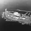
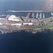
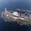
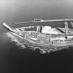
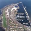
Troon Harbour, Lifeboat Station
Lifeboat Station (19th Century) - (20th Century)
Site Name Troon Harbour, Lifeboat Station
Classification Lifeboat Station (19th Century) - (20th Century)
Alternative Name(s) Troon, Lifeboat House
Canmore ID 281404
Site Number NS33SW 23.13
NGR NS 30939 31534
Datum OSGB36 - NGR
Permalink http://canmore.org.uk/site/281404
- Council South Ayrshire
- Parish Dundonald (Kyle And Carrick)
- Former Region Strathclyde
- Former District Kyle And Carrick
- Former County Ayrshire
NS33SW 23.13 30939 31534
Lifeboat Station [NAT]
OS 1:10,000 map, 1986.
Lifeboat Station [NAT]
OS (GIS) AIB, May 2006.
In 1871, a lifeboat house was built in Portland St, the boat being rolled out and lowered by crane into the coaling basin [location unclear]. This house was used until 1904, when moorings were taken in the Inner Harbour [NS33SW 23.17] beyond the Gut Bridge [NS33SW 23.20]; the boat was kept on moorings the year round, and the lifeboat house sold.
In 1929, new shore facilities were built on the shipbreakers' breakwater quay [location unknown]. In 1949, they were transferred to a site adjacent to the Inner Basin [Inner Harbour]; this was extended in 1981 to provide a crew room.
In 1987, a new crew assembly building was constructed on the quayside. This was extended in 1996.
N Leach 1999.


